Ray Atkinson started this blog in 2014 when he moved from his childhood home in Kannapolis, NC (Walk Score of 0) to get his Master of Urban and Regional Planning degree from Portland State University (Walk Score of 100). He has never owned a car despite living in Memphis, TN. His email is gismap1@gmail.com https://www.linkedin.com/in/rayplans
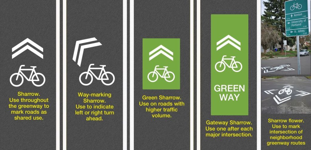
Biking in Memphis has given me a new appreciation for the creative sharrows that I depended on for wayfinding when biking in Portland, OR. Since I have heard many bike advocates throughout the US dismiss paint as not safe enough bike infrastructure, I wanted to share how paint can actually be used to improve the safety of bike infrastructure. I have learned during my first seven months biking in Memphis that many people, especially “interested but concerned” cyclists, are unaware of safer neighborhood routes to avoid biking on dangerous highways. I believe a simple marking like a sharrow flower could provide the crucial, life-saving wayfinding that they need to find the safer neighborhood routes. As a feminist, I also believe this design could encourage more women to bike because women usually need to feel safer than men. Do you agree?
Sharrow Flower
I am trying to find an example of a sharrow flower in Memphis. Since I have not found a location so far, I am likely working on installing Memphis’ first sharrow flower. While I can’t share the location until the project is completed, I am excited to see how this project improves bike wayfinding in Memphis. I used to depend on sharrow flowers in Portland to direct me on how to stay on safer neighborhood bike routes, which are called neighborhood greenways. I want to create a similar neighborhood greenway system in Memphis. The low-hanging fruit to create this is to install sharrow flowers at intersections to connect the existing sharrows.
Another low-hanging fruit idea to create a neighborhood greenway system in Memphis is to add way-marking sharrows. These sharrows would help direct cyclists at T-intersections and other unusual wayfinding gaps in the bike network. Memphis usually puts straight sharrows on every block, so using way-marking sharrows would be a new approach.
Future Blog Post
I need to leave for an evening event. I plan to add more to this post later. Hopefully, I will be able to start writing more soon about the Safe Streets and Roads for All Safety Action Plan that I am managing.
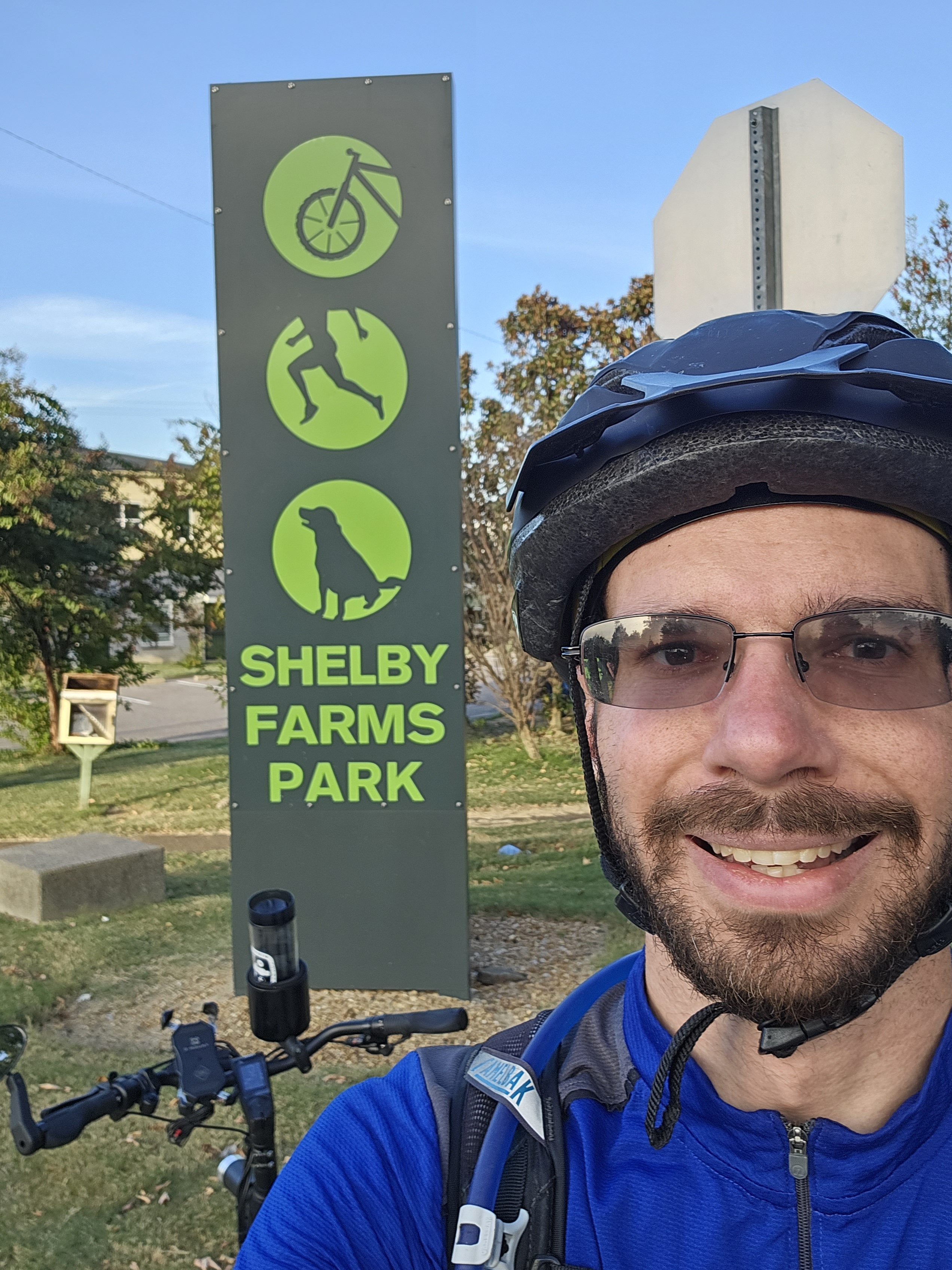
“Memphis at Eye Level: Part 1” is a reference to “The City at Eye Level”. I want to highlight my favorite Memphis bike route so far. I realize that I have not explored every Memphis neighborhood yet, so I may find a new favorite route. As I stated during my interview with Tulio from the Memphis Hightailers Bicycle Club, I have been pleasantly surprised by Memphis’ bike infrastructure across the Mississippi River at the Big River Crossing and between Downtown and Shelby Farms Park.
I am thankful to work with coworkers who value my passion for active transportation. I treasured receiving this handwritten letter from Matthew more than receiving an email.
Handwritten letter from Ray’s coworker
Ray’s Favorite Memphis Bike Route
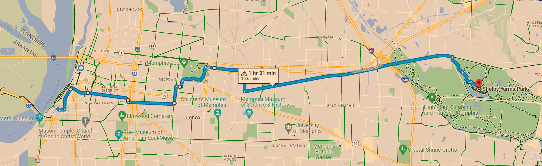
I wish that I had stopped to take more photos while biking because my usual “The City at Eye Level” post is not going to be as visual as I prefer. At least I can share a map of my favorite Memphis bike route. Yes, it takes about 90 minutes. I usually stop on the way for a meal and to do errands. I enjoy the variety of bike infrastructure, which starts with speed bumps on Front St, protected bike lanes on MLK Ave, bike lanes on Peabody Ave and McLean Blvd, low-volume side streets on Jefferson Ave and Tucker St to more easily access Overton Park, wooded car-free roads in Overton Park, multi-use trails called the Hampline and Greenline, and ends with wooded trails in Shelby Farms Park.
Ray’s favorite Memphis bike route. Source: Google Maps
Yes, I wish Peabody Ave connected directly to the Greenline when I am in a rush. However, I do not mind the extra distance through Overton Park too much because I enjoy forest bathing in Overton Park. As this map shows, there are plans to extend the Greenline closer to Peabody Ave. The Shelby Farms Greenline Western Extension should be connected to the South Memphis Greenline Phase 1 someday. An on-street connection will likely be needed to safely connect these future extensions to Peabody Ave. I should clarify that this is my personal opinion and not the opinion of the City of Memphis’ Bikeway and Pedestrian Program, which I manage. Do you see the South Memphis Greenline Phase 1 in the bottom left corner and how it could someday connect to the Shelby Farms Greenline?
In addition to improving the active transportation networks in Memphis, I am also looking forward to improving the City’s bike map to make it more user-friendly. For example, I want to make it easier for people to find safe routes and bike shops that will work on e-bikes. As an e-bike owner, I recommend All About Bikes. In case the bike shop is located too far, I also recommend Velotooler, which is a mobile bicycle service. I am located far from All About Bikes, so I have been trying to improve my bike repair skills. Since it is tough to change an inner tube without help, I was thankful to have a Memphis friend help me when I got a flat tire. I now carry everything on my bike that I need to change an inner tube without needing to stop at a bike shop. I still support bike shops, especially local shops, but they are not always nearby when I get a flat tire.
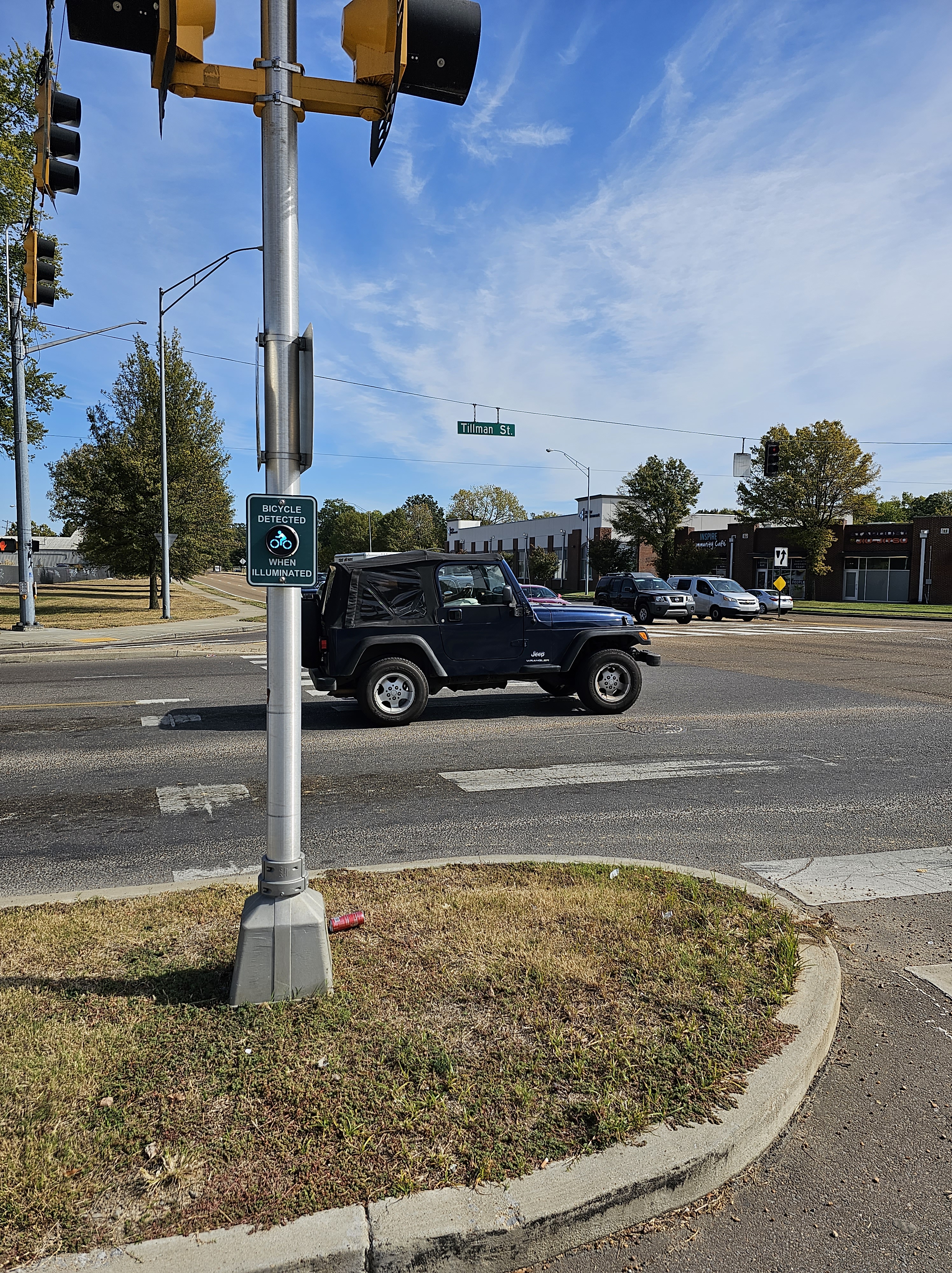
I also want to spotlight the importance of signals in creating safe active transportation networks. While the above map does not show bike-specific signals, I have found these signals helpful. The below bike signal is in Memphis on the Hampline at Tillman St as it crosses Sam Cooper Blvd. I would love to take this signal to the Dutch standard by adding a wacht signal (wacht is Dutch for “wait”). As I showed in this 2015 post from when I studied abroad in the Netherlands, the wacht signal allows people biking to see how long the wait time is for the signal to turn green. Since the Dutch standard is usually not legally allowed in the US, I was excited to see Portland (OR) install a wacht signal in 2015. I was actually in Portland when this signal was installed. I got to experience using it when I biked in Portland. I realize that Memphis has a unique culture and may not want to copy what Portland does. I look forward to collaborating with Memphians to create a unique approach that accomplishes the same goal of improving bike signals in Memphis.
Do you see the “bicycle detected when illuminated” signal on the Hampline at Tillman St as it crosses Sam Cooper Blvd? Photo: Ray Atkinson
The “bicycle detected when illuminated” signal coordinates with the bike signal on the Hampline to cross Sam Cooper Blvd in Memphis. Photo: Ray Atkinson
My favorite artistic part of the Hampline is the upcycled tires that are found on Broad Ave, which is just north of Sam Cooper Blvd. The photo below does not show the upcycled tires well, so I need to take a zoomed in photo when I bike on Broad Ave again. The upcycled tires are produced by locals at the Binghampton Development Corporation, which has an inspiring process of hiring at-risk locals. I got to tour their process during the Binghampton Tour. I tweeted (does X still call them tweets?) from the Bike Ped Memphis account during the TAPA Conference.
Photo of upcycled tires on the Hampline during the Binghampton Tour. Photo: Ray Atkinson
Improving How Ray Navigates While Biking
Even though I majored in Geography at UNC Charlotte and love studying maps, I will admit that I sometimes struggle to navigate Memphis without looking at a map. Due to this issue, I decided to back this $700 Kickstarter for Minimis’ augmented reality (AR) glasses. Assuming the glasses are shipped on time, I should receive them by next summer. I am looking forward to publishing a blog post about my experience using the expensive glasses!
Minimis Glass Prototype video. Source: Minimis
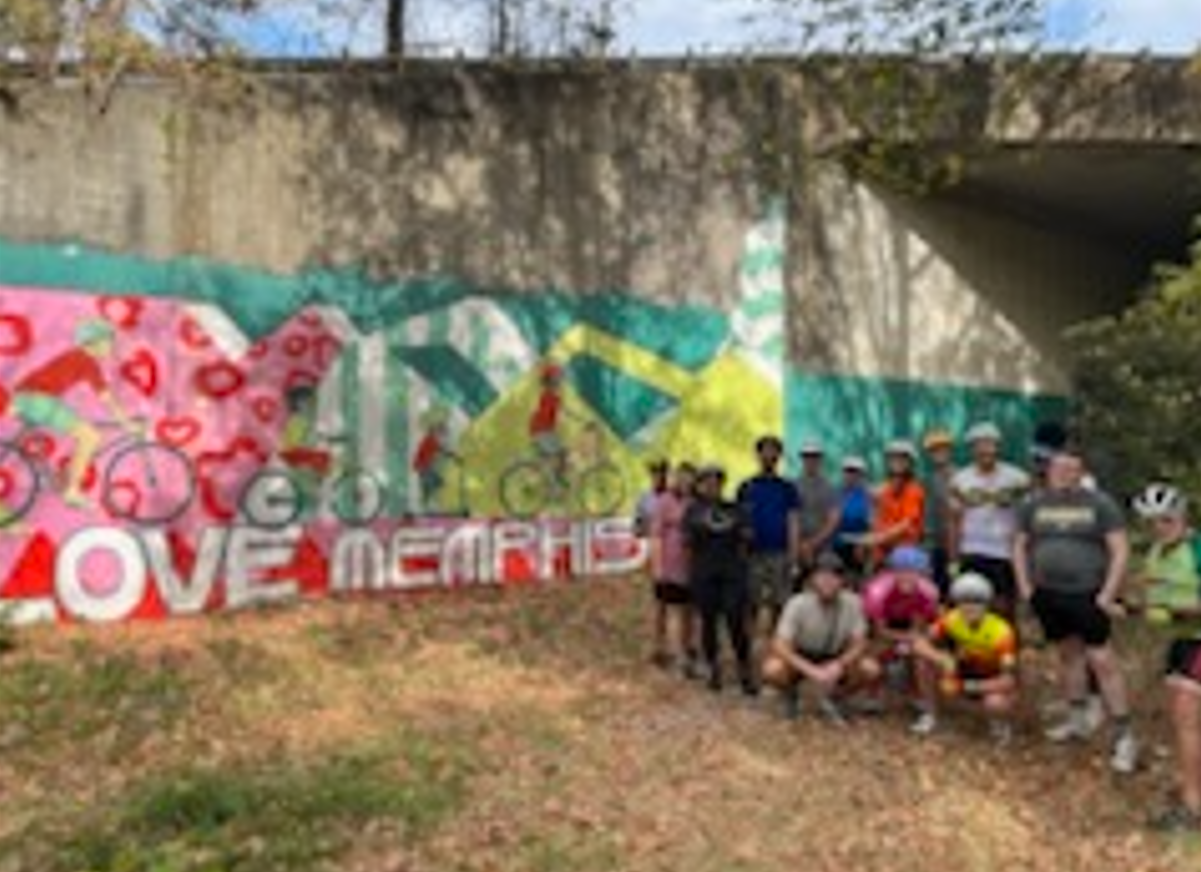
Since I prefer to socialize when biking, I am thankful that I have been invited to participate in several slow group rides in Memphis. The below ride along the Greenline was unique because it was the first large group ride organized by City of Memphis employees. While I did not feel comfortable taking photos of kids during the Carpenter Art Garden’s kid-friendly group bike ride, I also had an amazing experience helping to lead this weekly group bike ride along the Hampline and Greenline. One of the kids actually hugged me after the ride to thank me for helping!
Hopefully, someone took a high-quality photo!
Biking the Greenline in Memphis. Photo: Ray Atkinson
Future Blog Post
I was originally planning to write about my experience volunteering on the Urban Bicycle Food Ministry’s weekly bike rides. Since I have not participated in the Wednesday evening or Saturday morning ride yet, I will need to postpone blogging about this experience.
I wanted to share a few more thoughts about Arcata before I depart tomorrow to hike and kayak with my retired friend, Stephen Walton, in Redwood National Park. As a reminder, I am still writing this post on my phone because I decided to leave my laptop at home. “Arcata at Eye Level: Part 2” is a reference to “The City at Eye Level”.
Importance of flipping stop signs on bike boulevard
I seeked out biking on Portland’s neighborhood greenways when I lived in Portland because I could avoid having to stop at every minor crossing. Unfortunately, Arcata did not design its bike boulevard (aka neighborhood greenway) the same way. While Arcata signed bike boulevard routes, I believe there were stop signs at every intersection. Flipping the stop signs at intersections with two stop signs or removing the stop signs on the bike boulevard at four-way stops is an easy and cheap way to prioritize people using the bike boulevard. As I have also been observing in Petaluma, it can be challenging to gain support from motorists for this idea because cyclists would be prioritized over motorists. Has your city flipped any stop signs to prioritize people over cars?
Arcata bike boulevard. Photo: Ray Atkinson
Car parking access using trail looks similar to approach used in Houten, Netherlands
I was so surprised by seeing car parking access provided using a trail in Arcata that I asked people walking by whether cars actually drive on the trail to access car parking. While the people walking did not understand what I was asking because they just said it’s a trail, I plan to ask the City of Arcata staff how this arrangement works. Since the intersection sign shows L Street and not a trail name, it appears that this section of L Street was converted to a trail. Due to this being a trail, I am also curious why the sign has “road” in it. A trail is not a road, so does the Manual on Uniform Traffic Control Devices (MUTCD) not have a sign that states “Trail Closed To Thru Car Traffic”?
“Road Closed To Thru Traffic” sign next to car parking on trail in Arcata. Photo: Ray AtkinsonCar parking that can only be accessed from the trail in Arcata. Photo: Ray Atkinson
The photo below is from when I biked in Houten, Netherlands. The car parking connection to the trail looks very similar to the approach used in Arcata. While I am not sure whether people in Houten actually drive on the trail, do you see how the car parking is connected to the trail?
Trail connected to car parking in Houten, Netherlands. Photo: Ray Atkinson
Future Blog Post
My vacation continues tomorrow in an area of northwest California that I have not explored yet. My friend and I plan to hike and kayak in Redwood National Park through Friday. Since one of my vacation goals is to be off the grid as much as possible, I am looking forward to having limited or no internet and cell services through Friday. While Arcata put the bar high in weird and surprising approaches to transportation planning, I hope to see more weird transportation planning approaches that surprise me. Am I surprised too easily, or are you also surprised by what I found?
I am currently on the bus to a doctor’s appointment in Santa Rosa, which is located north of Petaluma. Due to this, my post is short. While the post is short, I hope having less to read will mean more readers will engage with my question this time. Since I believe the answer to my question in my last post is simple but unlikely to be achieved in automobile-dependent Petaluma unless the public is willing to change their travel behavior, I wanted to share this fascinating BikePortland article from this week. Specifically, I want your attention to focus on the thoughts below from Portland’s long-serving and leading bike planner. I have also heard “if you build it, they will come” from Petaluma bike planners. Do you think Petaluma will have the same bike commute decline after it builds more bike infrastructure as Portland is currently experiencing despite building more bike infrastructure? How do you think this question relates to my question about the power of slowing down?
Geller, who’s worked in PBOT as a bike planner since the 1990s, shared a presentation with BAC members titled, Why has bicycle commuting/bicycling been in decline in Portland (2014-2019)? (PDF)
“I’m really kind of stumped,” Geller said at the outset of his presentation, “I’ve been in this position for a long time and the general thinking has always been, ‘build it and they will come.’” Geller explained how PBOT built new bike infrastructure each year and the rise in bicycle use followed up until a peak of 7.2% of commute trips in 2014. “But then things changed and the numbers began to drop,” he said.
“The network has grown, the quality of the network has grown,” he continued. “And so this is why it’s kind of confounding because our strategy of ‘build it and they will come’ is just not working anymore.”
BikePortland
Do you see any cyclists riding in this Portland bike lane surrounded by parked and moving cars? Could Portland’s car dependency be preventing people from biking? Source: BikePortland
Future Blog Post
I have other ideas on how to continue writing about the power of slowing down and its impact on creating robust in-person social networks. Do you enjoy reading about my perspective on this topic?
One of the reasons why I accepted the City of Petaluma’s offer to be the Senior Transit Planner is because I feel strong commitment from the City staff to achieve carbon neutrality by 2030. As a planner, I am used to goals gathering dust in a plan, leaders not being fully committed to achieving the goals, or the language of the goals being weakened. In case you notice, I have never published a post about climate change before. While I consider myself to be a lifelong learner, the main reason why I have not published on this topic before is I am not a climate change expert.
Thankfully, my knowledge of this topic is not as bad as my Spanish skills, which I am struggling to improve through Duolingo. Learning a language as an adult is tough! I wish I had focused more on learning Spanish and other languages when I was younger. I took French at Northwest Cabarrus High School, which is located in North Carolina, because all of the Spanish classes were full. I have forgotten most of what I learned because I have not used French recently. Selfishly, I wish most non-English speaking Petalumans would speak French because my French is still better than my Spanish.
Sorry for the tangent. I have been stressed about struggling to learn Spanish. Since most non-English speaking Petalumans speak Spanish, I guess this is not a tangent because being bilingual in Spanish would help me be able to do outreach to Spanish-speaking Petalumans.
Clackamas County (Oregon) Climate Action Plan Proposes 2050
I hate to embarrass Clackamas County, which is located in the Portland, OR region, but I feel the need to share what they are doing wrong in hopes that other government agencies will do better. While I represented Clackamas Community College (CCC) on the Community Advisory Task Force (CATF) for the Clackamas County Climate Action Plan, my personal perspective in this post does not represent CCC’s perspective. Since CCC never took a stance on the controversial I-205 Toll Project, which is a critical project when deciding how to achieve carbon neutrality by 2050, I actually did not feel fully able to represent CCC on the CATF. The main reason why the I-205 Toll Project is a critical project is the transportation sector generates the largest share of greenhouse gas emissions. How can Clackamas County possibly achieve carbon neutrality by 2050 when it supports widening I-205 (whether or not to create a toll is another issue)?
While 2030 is not here yet, the energy (pun intended) I feel from my coworkers and City Council give me confidence that we will achieve carbon neutrality by 2030. The below photo and link are included in the City staff email signatures. Since the link informs the public about how they can help the City achieve carbon neutrality by 2030, I believe the “I’M READY” refers to every person in Petaluma being ready to work together towards achieving this goal.
Petaluma’s goal is ambitious because I believe cities usually just make sure their goal complies with the state’s goal. As the below background shows, California’s carbon neutrality goal is 2045. While the background states that the City of Petaluma committed the City to this same timeframe, the City Council adopted the more rigorous 2030 goal during its January 11, 2021, special meeting.
Source: Climate Emergency Framework
As the Senior Transit Planner, I am working with my coworkers to achieve the below Climate Emergency Framework goals. Due to how expensive converting Petaluma Transit’s fleet to non-combustion vehicles is, we have been applying for grants to purchase battery-electric buses. While this conversion process could take longer than 2030, we are hopeful that converting as much as possible of our fleet to battery-electric buses by 2030 will help us achieve the carbon neutrality goal.
Source: Climate Emergency Framework
In case you are wondering how the electricity is generated, Petaluma Transit’s hybrid electric buses are currently powered using Sonoma Clean Power’s EverGreen Program, which uses geothermal energy from geysers and solar energy from six local projects in Sonoma and Mendocino Counties. Surprisingly, Sonoma Clean Power is the only utility in California to provide the option of using 100% renewable, locally produced energy day AND night. While the power generation details are not final, EverGreen Program should be used for most or all of the power needed to operate the battery-electric buses.
As hopeful as I am about Petaluma achieving carbon neutrality by 2030, I believe converting to battery-electric buses will not be enough to achieve this goal. Many Petalumans will also need to shift from driving to walking, biking, and riding transit. One way the City of Petaluma is trying to encourage this shift is through projects like the Rainier Avenue Demonstration Project. Since this is a temporary project, I am curious to see whether the project becomes permanent. Due to many negative Nextdoor comments about this project from angry motorists, who do not like change in their neighborhood and believe no one bikes in Petaluma, I am concerned that the project may not become permanent when Rainier Avenue is repaved and restriped in 2023. While City staff and City Council feel energized to achieve carbon neutrality by 2030, are car-dependent Petalumans open to making a shift from driving to walking, biking, and riding transit? If not, can Petaluma still achieve carbon neutrality by 2030?
While I could write more, I am getting tired. It is almost midnight, so I should publish this post and go to bed. As I think about future blog posts, I could also write about my car-free trips in Petaluma and throughout the Bay Area. Since I keep getting sick (not bad enough to be hospitalized) and California just had a record-breaking heat wave, I have not traveled beyond Petaluma for several weeks. My 32nd birthday is on September 19, so I want to do something special for my birthday. This may give me something to blog about. I am open to suggestions. What do you want to read?
The surprise I have been patiently waiting to publicly share is that I accepted a new job as the Senior Transit Planner at the City of Petaluma, CA. The below map shows where Petaluma is located in California. Yes, I had to research where Petaluma is located when I applied for the job. I had never even visited Petaluma before applying for the job. Coincidentally, my Portland friend, Linn Davis, is working on this project in Petaluma for Healthy Democracy. He got me excited about accepting the job and moving to Petaluma.
My last day working at Clackamas Community College (CCC) was July 18. Even though I struggled with being asked to represent CCC and Clackamas County on regional transportation committees because I have never owned a car (most students and residents own a car), I frequently advocated for these regional committees to add more voices from Clackamas County. I enjoyed working with many on- and off-campus partners during my four years at CCC. I actually worked more time in the COVID restrictions than before these restrictions. These restrictions drastically changed my work environment and likely permanently changed the future of CCC’s transportation services. I hope CCC finds someone who enjoys working in this new work environment.
While getting COVID during my move to Petaluma forced me to work from home with my new roommate for over a week, I started working for the City of Petaluma on July 25. I plan to share more about my new job and Petaluma after I share my other surprise.
Remembering Grandma Atkinson
I actually have two surprises. Unfortunately, the second surprise is not exciting. While I knew my paternal 96-year-old Grandma Atkinson was at the age to die soon, I am still struggling with her July 16 death in a Concord, NC hospital. Thankfully, I was able to be with her during the last week of her life. My twin sister and I visited her daily in the hospital or assisted-living facility during my North Carolina vacation. Our dad frequently joined us for the daily visit. My mom and brother also visited. These visits helped me feel more at peace when my grandma died. Despite my minimal cooking skills, I want to preserve the time with my grandma by making zucchini bread, which she frequently made.
Visiting Grandma Atkinson in Concord, NC hospital with my dad and twin sister
More pleasant memory in Erie, PA
Due to how much pain my grandma felt in the hospital and my desire to focus on how active and connected she was in Erie, I wanted to share a more pleasant memory from this 2017 post. I cannot believe this post was published over five years ago! My grandma knew everyone by name at her Erie retirement complex. I have difficulty remembering new names, so I wish that I had her skill to remember names. She was excited to introduce me to everyone during chair yoga. She would stop to talk with everyone in the hallways. While I am trying to focus on positive thoughts, the COVID restrictions negatively impacted her ability to socialize with everyone in her retirement complex. Even though she did not have COVID, the restrictions forced her to be isolated in her room, which made her very lonely. I was very concerned that she would die during this isolation, so I called her more frequently to give her someone to talk to.
Since my grandma died two days before I flew to Oakland, I am still amazed that I was able to focus enough to finish moving to Petaluma. I have been debating about what to share first about my new job and Petaluma. As a planner who enjoys reading history, I think sharing Petaluma’s planning history is a good starting point. I took a similar approach when I started blogging about Kannapolis in 2014. I can cover other topics about Petaluma in future posts.
Construction Industry Association of Sonoma County v. City of Petaluma
While I did not know where Petaluma is located when I studied the 1976 US Supreme Court case Construction Industry Association of Sonoma County v. City of Petaluma for the American Institute of Certified Planners (AICP) exam, I believe this case is the most important case to impact Petaluma’s planning history. As this post from Petaluma historian John Patrick Sheehy shows, I can thank former Petaluma mayor Helen Putnam for taking the case all the way to the US Supreme Court in order to limit Petaluma’s sprawl in the 1970s. In addition to preventing sprawl in Petaluma, the court’s decision helped cities across the country prevent sprawl. Surprisingly, former Mayor Putnam did not envision herself as a torchbearer of the urban slow-growth movement (aka smart growth).
Another important piece in Petaluma’s planning history occurred when the city council approved the Environmental Design Plan in 1972. This plan limited new development to 500 units per year for the next five years; 250 on the east side and 250 on the west side. It also included an urban growth boundary around the city. Yes, Petaluma created an urban growth boundary before Portland created its boundary in 1979. The below map shows Petaluma’s current urban growth boundary. Since I thought this boundary would not expire, I was surprised to learn Petaluma’s urban growth boundary will expire in 2025, unless extended by the voters. I believe urban growth boundaries in Oregon do not expire.
The reason why I am focused on how former Mayor Putnam limited Petaluma’s sprawl in the 1970s is because my new job involves doing transit planning for Petaluma. Sprawling land uses are not conducive to providing good transit service. Petalumans would likely drive more than they currently do if Petaluma had not limited its growth in the 70s. While the below 2016 map does not show the current transit system, the current transit map does not have a basemap to provide context for the transit routes. As you can see from the changes that were made to the transit system, planners are still struggling to provide good transit service in Petaluma even with the urban growth boundary.
I could write more but this post is getting long. I am debating what to write about next. I could write about my new commute in Petaluma and how it could impact my goal to settle down. Since I am new to Petaluma and the Bay Area, I could write about my car-free trips in Petaluma and the Bay Area. I am open to suggestions. What do you want to read?
I was invited to present through Zoom at the 2022 GIS for Activism Conference, which was organized by the GIS Club at Portland State University, about how I use my blog to do GIS activism. While I did not start blogging to do GIS activism, I have used my blog sometimes to do GIS activism. I chose to use this 2015 post to show how valuable Level of Traffic Stress analysis can be when creating official bike maps. You can watch a recording of my presentation from this link or the below video.
In case you are wondering how this topic relates to the Copenhagenize Index, I was asked after my presentation whether Portland is the best bike city. I may have answered “yes” if I was asked this question back when I lived in the Charlotte region and before studying abroad in Denmark and the Netherlands. I have studied international cities enough that I need to compare Portland to international cities. While the audience likely expected me to answer “yes” because Portland is frequently ranked by US-based websites as the best bike city in the US, I answered that Portland is not even ranked in the 2019 Copenhagenize Index! Zero cities in the US are ranked in the 2019 Copenhagenize Index!
Source: Copenhagenize Index
Yes, Portland was ranked in the first-ever Copenhagenize Index when it launched in 2011. This was the only time Portland made the list. Since I would not have included Portland in the first list, I hope the methodology was made more rigorous after 2011. Montréal is the only North American city to be ranked in the Copenhagenize Index every time. As these posts show, I visited Montréal in 2017. Vancouver (not Washington) joined Montréal in the Index in 2019. My Portland friends keep encouraging me to visit Vancouver. I may have to ride the bus or fly to Vancouver for the foreseeable future because Amtrak has postponed restoring its Cascades service to Vancouver until at least December.
Next Blog Post
No, presenting at the 2022 GIS for Activism Conference was not the surprise that I mentioned in my previous post. Hopefully, I will be able to share the surprise in my next post. Since I usually go on a vacation during the summer, could the surprise be about a future vacation?
I have been thinking about ways to change traffic signal timing in order to improve safety. While I see the value in making changes to traffic signal timing, I would need to work with a traffic engineer to actually implement my ideas. Due to how retiming traffic signals can produce a high return on investment, I am surprised that I have not blogged about this topic before. Since motorists almost hit me daily when I am walking through a Highway 213 intersection near my home, I should contact the Oregon Department of Transportation (ODOT) about programming Leading Pedestrian Intervals (LPI) within the signal timing of this intersection.
What is a Leading Pedestrian Interval?
The below graphics from this page in the Urban Street Design Guide, which is produced by the National Association of City Transportation Officials (NACTO), show what an LPI is and how it improves safety. Yes, I realize that motorists would be forced to wait for pedestrians to cross the intersection. Legally, motorists are already supposed to yield to pedestrians. While motorists may not support adding an LPI because many motorists are impatient, I hope they see the value of improving intersection safety.
LPIs have been shown to reduce pedestrian-vehicle collisions as much as 60% at treated intersections.
NACTO
Source: NACTO
What is Transit Signal Priority?
Due to how Transit Signal Priority (TSP) has been proven to reduce traffic congestion, I believe this is beneficial to all road users. The below graphic, which can be found here, from the Chicago region’s Regional Transportation Authority shows what TSP is and its benefits. While the Portland region does not have a cool infographic like the Chicago region, I am still excited about Portland’s Rose Lane Project. As someone who works in Clackamas County, which is south of the main area of Portland (a small section of Portland extends into Clackamas County), I wish the Rose Lane Project did not end at Portland’s city boundary. My main concern is how the jurisdictional transfer of 82nd Avenue from ODOT only includes Portland’s section of 82nd Avenue. Clackamas County’s section of 82nd Avenue is still owned by ODOT, which means that ODOT has to agree to any changes.
One element missing from the RTA graphic is a bus-only lane. Thankfully, NACTO includes bus-only lanes on this page about Active Transit Signal Priority within the Transit Street Design Guide. In case you are wondering, painted bus-only lanes are not good enough to create world-class Bus Rapid Transit (BRT). I refer to painted bus-only lanes as BRT-lite mostly because single-occupancy vehicles often end up in painted bus-only lanes. World-class BRT requires physical separation from single-occupancy vehicles. I recommend reading about world-class BRT in other countries.
Source: NACTO
Bike Signal Countdown Timer
While few people bike where I live, I still want to include my wish for bike signal countdown timers in Oregon City. As I wrote in this 2015 post, Portland has one wacht signal (wacht is Dutch for “wait”).
Next Blog Post
The topic of my next blog post is a surprise. Since I usually go on a vacation during the summer, could the surprise be about a future vacation?
I finally decided how I plan to celebrate passing the AICP exam! While I wanted to take a vacation in January or February, I decided to postpone visiting Tucson until March 26-April 3 because I want to participate in Cyclovia Tucson. Cyclovia Tucson is an open streets event, which creates a safe and fun place for people of all ages and abilities to enjoy the streets without being concerned about automobiles dominating the streets.
Yes, I am frustrated by how automobiles usually dominate most US streets. While I do not want to embarrass the Living Streets Alliance, especially when I am volunteering to help them organize Cyclovia Tucson, I wish US non-profit organizations and cities would think beyond organizing a temporary open streets event. It feels weird to be celebrating ten years of temporary open streets events when the streets are still dominated by automobiles when the event ends. People deserve to be able to use their local streets safely and for fun all of the time!
I want to encourage US non-profit organizations and cities to think about creating permanent change in automobile-dominated streets. I am not referring to constructing protected bike lanes and intersections, which are great for roads with higher speed limits and traffic volumes. I am referring to creating woonerfs, which were developed by the Dutch in the 1960s. My 2017 post about oasis greenways includes an even more radical approach to creating permanent change in automobile-dominated streets. I realize woonerfs or oasis greenways need very low speed limits and traffic volumes. Due to this, I am not suggesting that Tucson create a woonerf or oasis greenway on every street.
I am still excited about my vacation. I am not going to let my frustration regarding the lack of permanent changes prevent me from enjoying Cyclovia Tucson. I may even learn about some permanent street changes while I am exploring Tucson that occurred as a result of a previous Cyclovia Tucson. Since I have participated in open streets events in other cities like Portland and Milwaukie (yes, Oregon has a city that is spelled almost identical to the Wisconsin city), I am curious to see what unique activities the Living Streets Alliance has planned for 2022 Cyclovia Tucson. The below photo shows people during the 2018 Cyclovia Tucson zip lining in the middle of South Church Avenue!
Even before I learned about Cyclovia Tucson, I originally chose to visit Tucson because I want to explore 131-mile The Loop. Yes, 131 miles! I may not bike the entire distance during my first trip to Tucson. Due to how long The Loop is and my desire to explore Tucson beyond the tourist traps, I have actually been struggling to decide where to stay in Tucson. Do you think I should sleep in one place the whole time or move to different places throughout Tucson every few nights? If you think it is feasible to move to different places throughout Tucson every few nights, how would you approach transporting luggage during the day without using a car?
As I wrote these questions, I realized that I need to consider the feasibility of transporting my luggage between places. I have used Radical Storage (formerly Bagbnb) to store my luggage during the day before I could check in to an Airbnb. Unfortunately, Radical Storage has no locations available in Tucson. Since I do not plan to pack everything in panniers and will not have my bike in Tucson, I likely need to sleep in one place the whole time. I mention my bike because it has a rack to carry panniers. Tugo Bike Share, which is Tucson’s bikeshare system, does not have a rack capable of carrying panniers. I could research whether a Tucson bike shop has a rental bike with a rack capable of carrying panniers. Assuming I need to stay in one place the whole time, where do you think I should stay in Tucson?
The final thing that I am currently focused on doing in Tucson is attending the Tucson Folk Festival before flying back to Portland on April 3. I actually would not have been in Tucson for this festival if I proceeded with purchasing flights during Clackamas Community College’s spring break, which is March 21-25. I was trying to schedule my vacation during spring break to reduce the impact of my vacation on my coworkers. Since I am the only staff person who manages certain student transportation benefits, I am planning to train some of my coworkers on how to enroll students in these benefits during my vacation. While I may need to stop being frugal, the cheapest flight from Tucson to Portland after Cyclovia Tucson on March 27 was almost $1,000 one way!
My Tucson vacation is about two months away, so I may blog about something else before my vacation. Either way, I plan to blog more about my Tucson vacation at some point. Since I spend too much time looking at screens during the COVID restrictions, I may actually not publish daily posts about Tucson until after my vacation is over. I am concerned about writing posts when I want to be experiencing Tucson. Yes, this feels weird to write because I enjoy blogging. I want to make sure I return to work refreshed after my vacation. Reducing screen time is very important for me to return to work refreshed. In case you were hoping to see daily posts during my vacation, I hope you will understand my need to prioritize my health over blogging.
Today is the last day of 2021. I am trying to be hopeful about what will happen in 2022. I never thought I would experience what happened in March 2020. While some of the COVID restrictions have been lifted, I cannot believe we are still living through COVID restrictions almost two years later. Due to how political the issue of keeping or lifting the COVID restrictions has been, I need to be clear that I am focusing this post on how these restrictions are impacting my life and work. I am not advocating for the restrictions to be lifted. Yes, I would love for the restrictions to be lifted but I recognize that the pandemic is not over. I have close friends who have tested positive for COVID and they are currently fighting for their lives. I am thankful that I have not caught COVID. Hopefully, the vaccine and booster shots will prevent me from dying if I test positive someday.
Please do not replace in-person meetings with Zoom meetings in the new normal
I am disheartened by this thread. Five student teams pushed forward on capstone plans this quarter. They had to push all engagement online. They lost almost all communities of colors. It sounds more like ppl aren’t empowered to manage public mtgs. https://t.co/QWj1vS1wz1
— Some Woke PSU Professor (@DrMarisaZapata1) June 11, 2020
I wrote two blog posts (this 2020 post and this 2021 post) regarding how I am concerned about how many planning processes during COVID have depended solely on Zoom meetings to conduct public engagement. Before I share my thoughts about discussions during meetings, I want to be clear that the meetings were open to the public so I am not sharing information from sensitive internal discussions. I have been involved with many new normal planning meetings over the past several months. Despite the organizations (purposefully not naming the organizations) having an adopted Diversity, Equity, and Inclusion Strategic Plan, they have not changed their plans when I urge them to consider the harmful impact of depending solely on Zoom meetings to conduct public engagement. They keep saying that Zoom meetings will allow more people to participate, especially because people will not need to travel a far distance to participate in an in-person meeting. What about the people who do not have a reliable computer or internet access?
As an extrovert and someone who feels dehumanized by Zoom meetings and events, I miss spending time with friends and coworkers during in-person meetings and events. I also miss walking and biking to and during meetings and events. This has hurt my mental and physical health. Since I am usually in shape from walking and biking, it feels weird to create a new year’s resolution to get back in shape. The easiest way for me to achieve this is by walking and biking to and during in-person meetings and events. Will in-person meetings and events restart again in 2022?
Opportunity to encourage healthy travel behavior in the new normal
I am also thinking about big-picture changes in the new normal. I have found it fascinating how people are stumped when I ask them what they think the new normal means. The basic answer has been a hybrid work future where they can continue working from home and only commute to their office when they need to do in-person work. I have been trying to encourage people to think about big-picture changes. Pandemic-induced travel behavior may only happen one time in our lifetime. I see this as an opportunity to encourage healthy travel behavior before many in-person workers, who are currently still working from home, return to driving alone to work. What do people really mean when they get excited about the new normal?
I may have finally decided how to celebrate passing the AICP exam! I learned about Tucson’s 131-mile The Loop when researching the longest urban trails in the US. I still have to decide when, how long to visit, and where to stay in Tucson. Since I have never been to Arizona before besides having a layover in Phoenix, which does not count as visiting Arizona, I have been asking friends for help with planning my vacation. While I am still nervous about whether I will enjoy biking in Tucson more than doing an international vacation, my friends are excited to help me plan my Tucson vacation. I have been texting with a University of Arizona MD-PhD student, who I met when we were both students and bike advocates at Portland State University. I have also been texting with a University of Arizona MPH alum and Tucson high school graduate, who I met when we were both students at UNC Charlotte.