Ray Atkinson started this blog in 2014 when he moved from his childhood home in Kannapolis, NC (Walk Score of 0) to get his Master of Urban and Regional Planning degree from Portland State University (Walk Score of 100). He has never owned a car despite living in Memphis, TN. His email is gismap1@gmail.com https://www.linkedin.com/in/rayplans
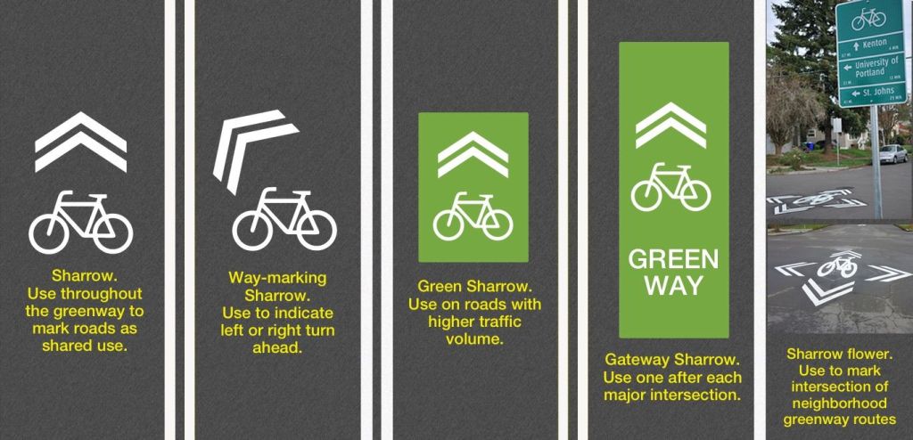
Biking in Memphis has given me a new appreciation for the creative sharrows that I depended on for wayfinding when biking in Portland, OR. Since I have heard many bike advocates throughout the US dismiss paint as not safe enough bike infrastructure, I wanted to share how paint can actually be used to improve the safety of bike infrastructure. I have learned during my first seven months biking in Memphis that many people, especially “interested but concerned” cyclists, are unaware of safer neighborhood routes to avoid biking on dangerous highways. I believe a simple marking like a sharrow flower could provide the crucial, life-saving wayfinding that they need to find the safer neighborhood routes. Do you agree?
Sharrow Flower
I am trying to find an example of a sharrow flower in Memphis. Since I have not found a location so far, I am likely working on installing Memphis’ first sharrow flower. While I can’t share the location until the project is completed, I am excited to see how this project improves bike wayfinding in Memphis. I used to depend on sharrow flowers in Portland to direct me on how to stay on safer neighborhood bike routes, which are called neighborhood greenways. I want to create a similar neighborhood greenway system in Memphis. The low-hanging fruit to create this is to install sharrow flowers at intersections to connect the existing sharrows.
Another low-hanging fruit idea to create a neighborhood greenway system in Memphis is to add way-marking sharrows. These sharrows would help direct cyclists at T-intersections and other unusual wayfinding gaps in the bike network. Memphis usually puts straight sharrows on every block, so using way-marking sharrows would be a new approach.
Future Blog Post
I need to leave for an evening event. I plan to add more to this post later. Hopefully, I will be able to start writing more soon about the Safe Streets and Roads for All Safety Action Plan that I am managing.
“Memphis at Eye Level: Part 2” is a reference to “The City at Eye Level”. I finally volunteered with the bike riding portion of the Urban Bicycle Food Ministry‘s program, which happens on Wednesday evening and Saturday morning. Since I am not an early bird, I was struggling for weeks to motivate myself to wake up early enough to volunteer with the Urban Bicycle Food Ministry. The Saturday morning program starts with cooking at 7am and delivers the food at 7:30am. I previously helped to cook for the Wednesday evening program. I wanted to deliver the food, but I needed to prioritize eating my own dinner. The program is during dinner time on Wednesday evening. The program celebrated eleven years this weekend.
As someone who was raised (felt forced to attend) in Bethpage Presbyterian Church, which is located in North Carolina, and now attends the Unitarian Universalists church called Church of the River in Memphis as I continue to evaluate my religious beliefs as an agnostic in the South’s Bible Belt, I actually find the video below to capture my viewpoint on religion more accurately than any traditional church video. I prefer to be outside the church walls helping my community rather than stuck inside the church walls just talking about how I could help my community. I also love how the organizer accepts anyone from any religion to volunteer. This is what a welcoming church environment should mean. I get frustrated when I see churches say that they are welcoming to only find out that they are only welcoming to people who agree with their viewpoint. I strongly believe churches should be a place where people can discuss and argue about controversial topics. Unfortunately, churches are all too often places for groupthink. I believe groupthink is how some wars were started and why some current wars have no end in sight. I hate groupthink!
Source: Urban Bicycle Food Ministry
Ray’s Experience Volunteering
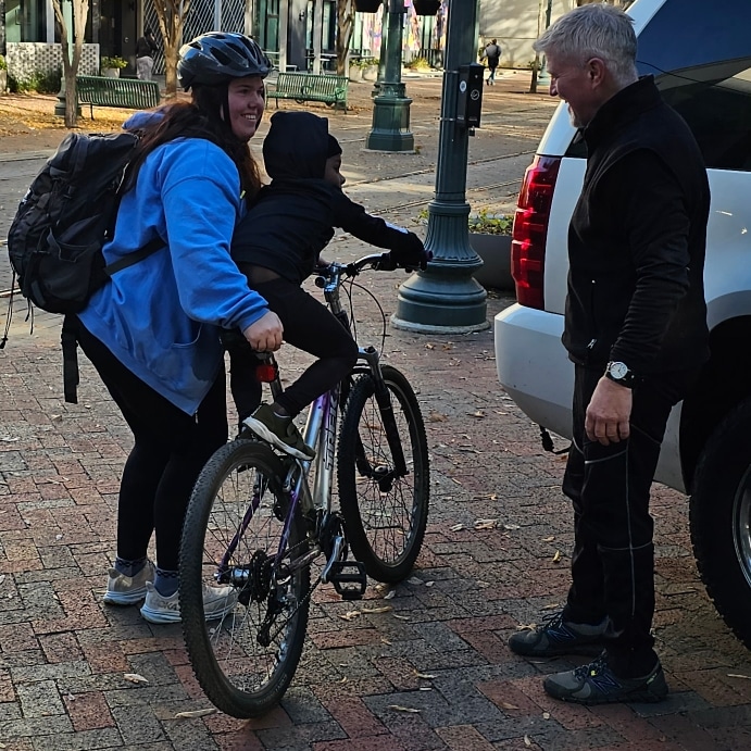
While I wish it did not take a special day to motivate me to get up early to volunteer with the Urban Bicycle Food Ministry, I finally motivated myself to wake up early when I felt the need to help veterans on Veterans Day. Unfortunately, veterans are more likely to be homeless than other Americans. I was impressed by the program’s operation. The homeless people and other struggling people that we encountered on Main Street were very aware of the program’s existence. They lined up to get a meal from me and the other volunteers. Since I was busy giving out the meals, I did not have time to get their permission to take photos. The organizers said I could take photos if I got permission from the people we were helping.
I may have broken this rule when taking the photo below. The kid got on the adult bike, and I did not have enough time to ask their parent for permission to take the photo before their kid got off the bike.
Involving Homeless People in Public Outreach Process
As I was volunteering, I kept thinking about how I rarely see homeless people in public outreach processes. While I will admit that I want biking and walking to be viewed as something that everyone does and not just low-income people, I realize that currently biking and walking for transportation in Memphis appears to be mostly done by low-income people. I should clarify that I specifically included “for transportation” because I have mostly seen wealthier people in Memphis bike and walk only for exercise. I usually see these people drive for transportation. I hope my work encourages these people to also bike and walk for transportation and view biking and walking as normal modes of transportation. I enjoyed seeing this when I studied abroad in Denmark and the Netherlands. Most people in these countries viewed biking and walking for transportation as normal parts of their culture.
As I try to change the walking and biking cultures in Memphis, I am concerned about how to get homeless people and others struggling on the street involved in my public outreach processes. Since they likely do not have computer or internet access, they likely are not aware of public outreach meetings. I likely will have to go to them instead of expecting them to come to a usual meeting room. Due to my limited budget, I am not suggesting that my program will always be able to do special engagement activities for people living on the street. I mostly wanted to share how this population is often excluded by typical public outreach approaches. Do you think that my program could partner with the Urban Bicycle Food Ministry to organize mobile public outreach activities?
Future Blog Post
I think a great opportunity to experiment with innovative public outreach approaches will be during the City of Memphis’ Safe Streets and Roads for All (SS4A) Action Plan creation process, which kicks off this month. Since the USDOT website publicly shares the grant amount, I can share that this action plan has $800,000 worth of federal and local funds. I view the homeless population and other vulnerable low-income street users as critical people to be involved in this planning process. I doubt the typical email and snail mail notification approaches and public outreach strategies will be effective at involving this population, especially due to the fact that they do not have an email address or physical mail address. Have you seen innovative approaches to notify and engage homeless people in your planning process?
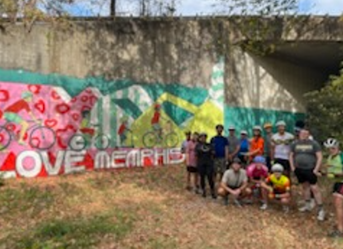
“Memphis at Eye Level: Part 1” is a reference to “The City at Eye Level”. I want to highlight my favorite Memphis bike route so far. I realize that I have not explored every Memphis neighborhood yet, so I may find a new favorite route. As I stated during my interview with Tulio from the Memphis Hightailers Bicycle Club, I have been pleasantly surprised by Memphis’ bike infrastructure across the Mississippi River at the Big River Crossing and between Downtown and Shelby Farms Park.
I am thankful to work with coworkers who value my passion for active transportation. I treasured receiving this handwritten letter from Matthew more than receiving an email.
Handwritten letter from Ray’s coworker
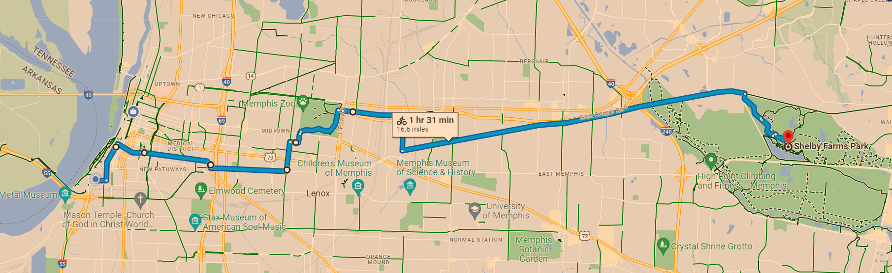
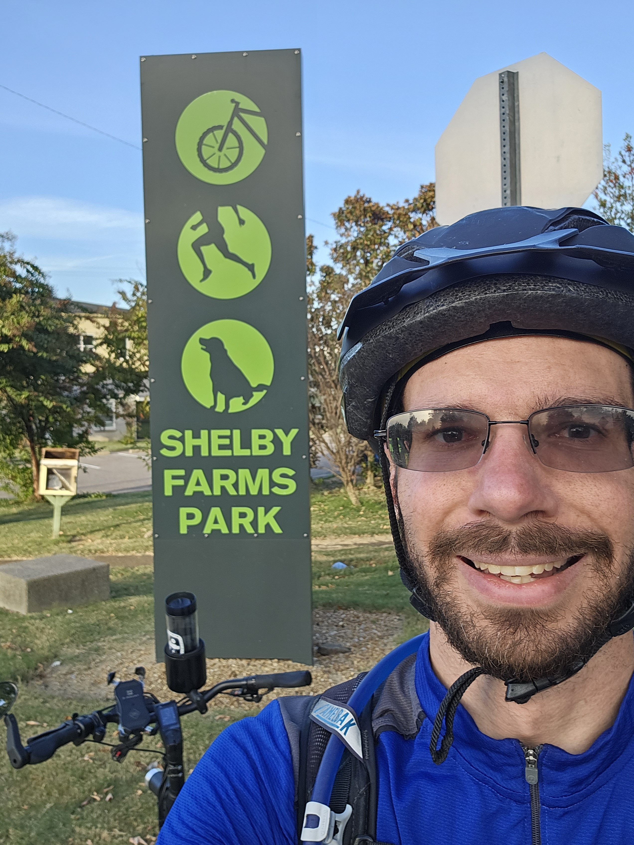
Ray’s Favorite Memphis Bike Route
I wish that I had stopped to take more photos while biking because my usual “The City at Eye Level” post is not going to be as visual as I prefer. At least I can share a map of my favorite Memphis bike route. Yes, it takes about 90 minutes. I usually stop on the way for a meal and to do errands. I enjoy the variety of bike infrastructure, which starts with speed bumps on Front St, protected bike lanes on MLK Ave, bike lanes on Peabody Ave and McLean Blvd, low-volume side streets on Jefferson Ave and Tucker St to more easily access Overton Park, wooded car-free roads in Overton Park, multi-use trails called the Hampline and Greenline, and ends with wooded trails in Shelby Farms Park.
Ray’s favorite Memphis bike route. Source: Google Maps
Yes, I wish Peabody Ave connected directly to the Greenline when I am in a rush. However, I do not mind the extra distance through Overton Park too much because I enjoy forest bathing in Overton Park. As this map shows, there are plans to extend the Greenline closer to Peabody Ave. The Shelby Farms Greenline Western Extension should be connected to the South Memphis Greenline Phase 1 someday. An on-street connection will likely be needed to safely connect these future extensions to Peabody Ave. I should clarify that this is my personal opinion and not the opinion of the City of Memphis’ Bikeway and Pedestrian Program, which I manage. Do you see the South Memphis Greenline Phase 1 in the bottom left corner and how it could someday connect to the Shelby Farms Greenline?
In addition to improving the active transportation networks in Memphis, I am also looking forward to improving the City’s bike map to make it more user-friendly. For example, I want to make it easier for people to find safe routes and bike shops that will work on e-bikes. As an e-bike owner, I recommend All About Bikes. In case the bike shop is located too far, I also recommend Velotooler, which is a mobile bicycle service. I am located far from All About Bikes, so I have been trying to improve my bike repair skills. Since it is tough to change an inner tube without help, I was thankful to have a Memphis friend help me when I got a flat tire. I now carry everything on my bike that I need to change an inner tube without needing to stop at a bike shop. I still support bike shops, especially local shops, but they are not always nearby when I get a flat tire.
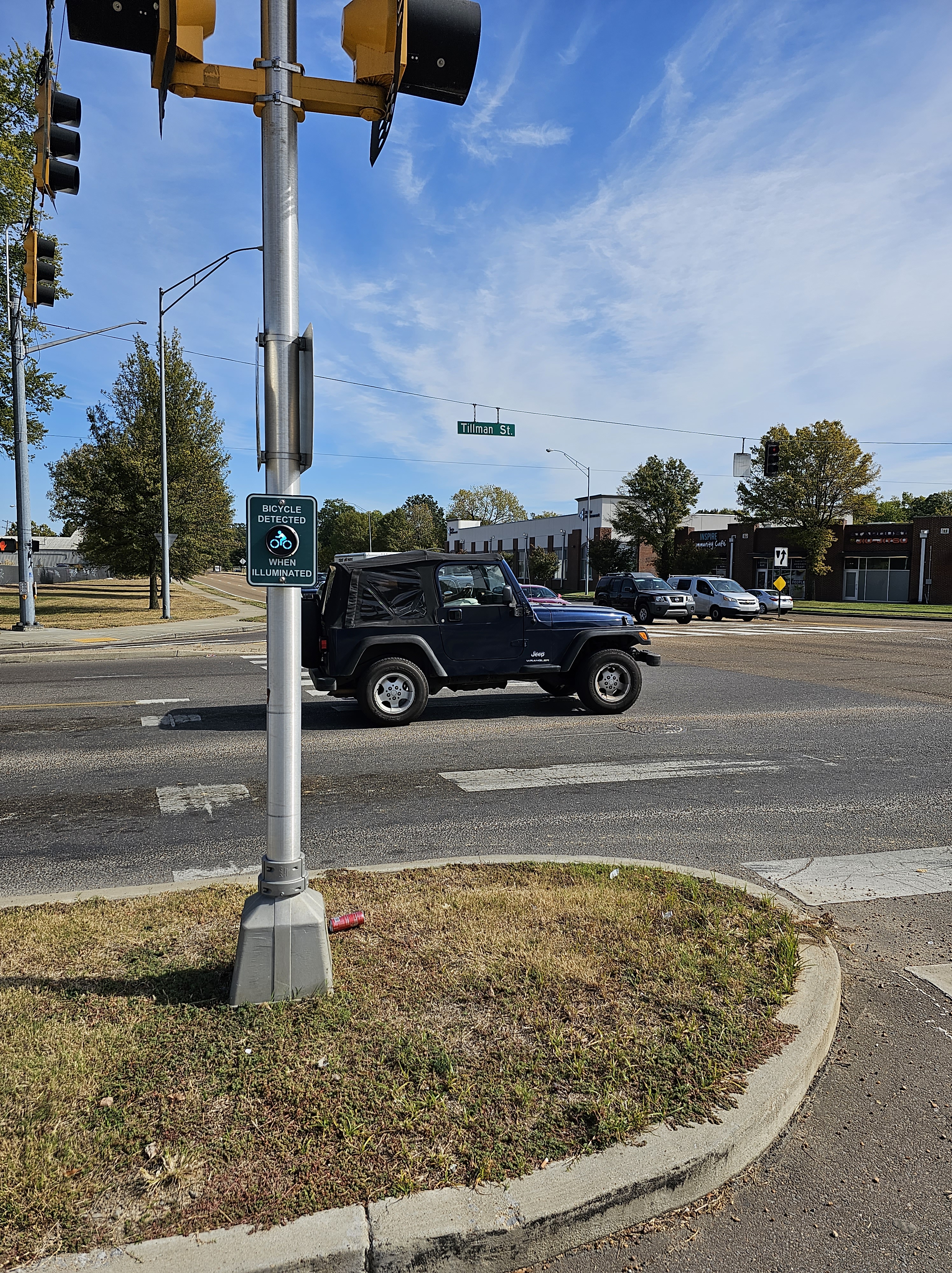
I also want to spotlight the importance of signals in creating safe active transportation networks. While the above map does not show bike-specific signals, I have found these signals helpful. The below bike signal is in Memphis on the Hampline at Tillman St as it crosses Sam Cooper Blvd. I would love to take this signal to the Dutch standard by adding a wacht signal (wacht is Dutch for “wait”). As I showed in this 2015 post from when I studied abroad in the Netherlands, the wacht signal allows people biking to see how long the wait time is for the signal to turn green. Since the Dutch standard is usually not legally allowed in the US, I was excited to see Portland (OR) install a wacht signal in 2015. I was actually in Portland when this signal was installed. I got to experience using it when I biked in Portland. I realize that Memphis has a unique culture and may not want to copy what Portland does. I look forward to collaborating with Memphians to create a unique approach that accomplishes the same goal of improving bike signals in Memphis.
Do you see the “bicycle detected when illuminated” signal on the Hampline at Tillman St as it crosses Sam Cooper Blvd? Photo: Ray Atkinson
The “bicycle detected when illuminated” signal coordinates with the bike signal on the Hampline to cross Sam Cooper Blvd in Memphis. Photo: Ray Atkinson
My favorite artistic part of the Hampline is the upcycled tires that are found on Broad Ave, which is just north of Sam Cooper Blvd. The photo below does not show the upcycled tires well, so I need to take a zoomed in photo when I bike on Broad Ave again. The upcycled tires are produced by locals at the Binghampton Development Corporation, which has an inspiring process of hiring at-risk locals. I got to tour their process during the Binghampton Tour. I tweeted (does X still call them tweets?) from the Bike Ped Memphis account during the TAPA Conference.
Photo of upcycled tires on the Hampline during the Binghampton Tour. Photo: Ray Atkinson
Improving How Ray Navigates While Biking
Even though I majored in Geography at UNC Charlotte and love studying maps, I will admit that I sometimes struggle to navigate Memphis without looking at a map. Due to this issue, I decided to back this $700 Kickstarter for Minimis’ augmented reality (AR) glasses. Assuming the glasses are shipped on time, I should receive them by next summer. I am looking forward to publishing a blog post about my experience using the expensive glasses!
Minimis Glass Prototype video. Source: Minimis
Since I prefer to socialize when biking, I am thankful that I have been invited to participate in several slow group rides in Memphis. The below ride along the Greenline was unique because it was the first large group ride organized by City of Memphis employees. While I did not feel comfortable taking photos of kids during the Carpenter Art Garden’s kid-friendly group bike ride, I also had an amazing experience helping to lead this weekly group bike ride along the Hampline and Greenline. One of the kids actually hugged me after the ride to thank me for helping!
Hopefully, someone took a high-quality photo!
Biking the Greenline in Memphis. Photo: Ray Atkinson
Future Blog Post
I was originally planning to write about my experience volunteering on the Urban Bicycle Food Ministry’s weekly bike rides. Since I have not participated in the Wednesday evening or Saturday morning ride yet, I will need to postpone blogging about this experience.
Greetings from Memphis! I wanted to publish a post when I moved to Memphis during Labor Day weekend. I felt the need to postpone blogging because I have been busy with moving, unpacking, organizing, meeting neighbors, and preparing for my new job, which starts on Monday, September 11th.
Podcasts About Ray’s New Job
In case you are curious to learn more about my job, I recommend listening to the below podcasts where my predecessors and other people were interviewed about their active transportation work and the future work that I will be managing. Due to the history that is shared in each podcast, I recommend listening to Episode 3 first before proceeding to the next podcast. I copied the episode descriptions, so the descriptions were not created by me. As you will hear in the podcasts, my predecessors and other passionate champions did impressive work to help Memphis become known as a national active transportation leader!
Making bikes affordable to more people by founding Revolutions Community Bicycle Shop led Anthony Siracusa to bike advocacy work on the local, state, and national levels. In time, he saw the bike as only one lever to affect change among many. Anthony’s doctoral studies at Vanderbilt deepened that knowledge by showing him the many Champions and their causes within the Civil Rights Movement. That led him to his current work at Colorado College, where he helps students better champion their own causes.
Kyle Wagenschutz was a critical figure in growing and sustaining Revolutions Community Bicycle Shop in Memphis, alongside founder Anthony Siracusa. Together, the two shared a love for bikes and punk rock, and they found that each subculture played a role in helping them build a community around bikes. Kyle advocated for bike lanes in Memphis, first from his perch at Revolutions, but then as the City of Memphis’ first bicycle/pedestrian coordinator. Anthony and Kyle’s effective “inside-outside” game showed what can happen when government and grassroots work together. The two friends’ partnership helped move Memphis from a “worst city for biking” to “most improved” and on to being a national leader in just six years. Now the Director of Local Innovation at PeopleForBikes in Boulder, CO, what Kyle learned through trial and error in Memphis is benefiting people in other cities.
Episode 30: Nick Oyler is not on the Champions of the Lost Causes’ website, so you will need to access it through this Google Podcasts link. The episode 30 description is below:
Nick Oyler is the Bikeway & Pedestrian Program Manager for the City of Memphis. When the push for bike lanes in Memphis resulted in early victories for the bike/ped movement and then gave way to the city’s initial buildout, Nick was away at college, grad school, and then working in Germany. Following all that news from afar, Nick thought that he might have missed his moment to get involved. But as many multifaceted causes require, there was plenty of work left to be done when he got back to his hometown. Nick’s experience of riding a bike when he was young helped pave the way for his interest in city planning and to his current role, and helped him see the many benefits to cities and people of having a well-designed system of bike lanes and walkways. Memphis has come a long way, but it still has a lot of work ahead of it.
Champions of the Lost Causes
John Paul Shaffer from PeopleForBikes and Nick Oyler from the City of Memphis join us to talk about how Memphis has gone from 2 to 300 miles of off- and on-road bicycle facilities over a decade; which projects have been truly transformative, such as Shelby Farms Greenway and the Harahan Bridge Crossing; and how an intentional focus on equity and neighborhood-based programming has helped more Memphians get on bikes for recreation and transportation.
Later in the program, regular commentator Charlie Santo reflects on moving from transportation mecca Portland, OR to Memphis and trying to navigate the local system. Charlie and Emily also talk about how bike infrastructure and related improvements like traffic calming can potentially help increase access to public spaces such as Tom Lee Park and Riverside Park.
Nick Oyler, bikeway and pedestrian program manager for the City of Memphis, makes a return visit to Memphis Metropolis to talk about pedestrian safety. This past week, Smart Growth America issued its Dangerous by Design 2021 study, which found that pedestrian deaths due to traffic accidents continue to increase nationally. Moreover, the study found that Memphis was the third most dangerous city for pedestrians, with pedestrian deaths up around 75 percent since 2019. In the show, Nick explains the connection between street design and pedestrian safety, why COVID and driver distraction have contributed to the rise in fatalities, and how dedicated funding for pedestrian infrastructure could help change the trajectory. And, why his team created a special map to help memorialize the lives of Memphis pedestrians that have been lost.
Pedestrian deaths in Memphis are at an all-time high and the city is one of the most dangerous in the U.S. for people who get around on foot. But while driver behavior and poor street design are the primary contributors to the problem, pedestrians themselves – the victims – are often blamed. Nick Oyler, Bikeway and Pedestrian Program Manager in the city’s engineering department, pays a return visit to Memphis Metropolis to discuss what the law actually says about where pedestrians can and cannot cross the street, why pedestrian behavior that seems illogical often is quite rational, and how “windshield bias” – seeing the problem exclusively from the driver perspective – is inhibiting the development of solutions.
Nick Oyler has spent the last several years working in and with the community to improve the city’s active transportation systems, first with the Memphis Metropolitan Planning Organization (MPO) and most recently as bike and pedestrian program manager for the City of Memphis. Nick is leaving Memphis to pursue new professional opportunities in Denver, and we asked him to return to Memphis Metropolis one last time to reflect on the successes, frustrations, and opportunities he has experienced during his tenure here.
A city’s ParkScore is a measure of how it compares to other places, using criteria such as access, acreage, equity, and investments. The ParkScore Index is prepared annually by the Trust for Public Land, a people-focused parks and public land advocacy organization. In this show, Noel Durant of the TPL’s Tennessee office visits Memphis Metropolis to talk about why ParkScores are so important and how Memphis ranked in their recent study. Memphis park advocates JoAnn Street also joins the conversation to provide a local perspective. JoAnn is the founder of HUG Park Friends, a support organization for three North Memphis parks, Hollywood, University, and Gooch.
Jackson McNeil, a longtime friend of Memphis Metropolis, recently joined Innovate Memphis as Director of Transportation and Mobility, overseeing the Commute Options program. In this show, we discuss the hard work of (and many obstacles to) getting Memphians out of their cars and onto alternate modes of transportation. Jackson and Emily also discuss the recently published Safe Speed Index, which ranks cities on the average vehicle speeds on streets used by pedestrians.
Ray’s New E-Bike Made His Car-Free Life Easier
Since my blog is focused on my car-free lifestyle, I wanted to share the most significant improvement to making my car-free lifestyle easier. As I shared in this 2022 post, my first e-bike did not fit on the bus bike rack because it was too heavy (58.4 pounds) and long (47″) to fit on the standard bike rack. Thank you to Brandie Macdonald for making me aware of the Wing Freedom ST.2 e-bike, which is light (39 pounds) and short (42.9″) enough to fit on the standard bike rack. I frequently had to leave my old e-bike at home in California because I knew it would not fit on the bus bike rack. I was excited to put my new e-bike on the bus bike rack when I went shopping in East Memphis last week!
I had to rush to get on and off the Memphis Area Transit Authority (MATA) bus, so I did not have time to take a photo of my e-bike on the bus bike rack. Taking selfies with my bike was possible on the Big River Crossing, which is an impressive and wide active transportation bridge between Tennessee and Arkansas. The views are fantastic! My new Memphis friends, who were also born and raised in the Charlotte region (all three of us went to high school in Cabarrus County!) and graduated from UNC Charlotte around the same time as me, invited me to join them on a walk across the Big River Crossing. I am not an early bird, especially when I prefer to sleep in during the weekend, so I felt accomplished with waking up in time for the 8am walk today!
Biking on the Big River Crossing. Photo: Ray Atkinson
View of downtown Memphis from the Big River Crossing. Photo: Ray Atkinson
My new church, The Church of the River (First Unitarian Church of Memphis), is near the trailhead to the Big River Crossing. I honestly had difficulty focusing on the sermon because the church has such an impressive natural view! I felt like I was forest bathing during church!
View from The Church of the River (First Unitarian Church of Memphis). Photo: Ray Atkinson
Future Blog Post
I am trying to keep this post short, so I will share more about Memphis in a future post. Since I have never seen a bike ride combined with cooking and feeding low-income people living on the street, I am excited to experience the Urban Bicycle Food Ministry’s weekly bike rides on Wednesday night and Saturday morning!
I usually refer my readers to “The City at Eye Level” because I typically write about cities at eye level. One weakness of this book is that it does not discuss the importance of forest bathing, especially for city residents with nature-deficit disorder. Since I did plenty of forest bathing during my vacation and even taught my retired friend about forest bathing, I want to push the envelope of what The City at Eye Level means by including the perspective of Redwood National Park at Eye Level.
Forest Bathing
I debated whether to share my forest bathing experience or my active transportation access concerns first. Due to how far Redwood National Park is from major cities and how many strong and fearless pedestrians and cyclists already use Highway 101, I doubt active transportation access to Redwood National Park will be improved anytime soon.
With my access concerns shared, I want to focus on the more relaxing topic of forest bathing. As I share photos of how I did forest bathing, I realize that these photos mean that I broke a rule of forest bathing by bringing my phone. This is one way that I wish that I was more like my retired friend who went hiking with me. While Stephen brought his iPhone, he rarely used it. He also rarely took photos. He prefers to live in the moment and not take photos. We picked on each other because our generations stereotypically approach technology so differently. Stephen is a baby boomer, and I am a millennial.
I will admit that it felt strange to hike with a baby boomer instead of fellow millennials. We talked with a group of millennials who were hiking on the same trail. Even though Stephen’s hair looks nothing like my hair, they asked if Stephen was my dad or related to me somehow. This is not the first time that I have received weird looks and been interrogated about why I am hanging out with someone who does not look like me. I used to date a Black woman in the Washington, DC region. We received weird looks during our dates, especially when we went into the Black neighborhoods on the east side of Washington, DC. Since I have been asked by dates whether I have a Black fetish, I should clarify that I have dated a variety of attractive BIPOC and white women. I do not only date Black women.
Using as many senses as possible while interacting with the forest is important when forest bathing. Since I did not take any videos, I can’t share how I used my sense of hearing when forest bathing. However, I can describe that listening to the creek ripples, ocean waves, sprinkles from the fog, and birds was relaxing.
Hiking during my Smith River kayaking trip. While the redwood trees look burnt to death, the trees likely never actually die because redwood trees clone themselves. Photo: Ray Atkinson
Learning about the heat-resistant layers of the redwood trees during my kayak and hiking tour was fascinating! Being in the redwoods during a fire would be safer than other forests. Photo: Ray Atkinson
Beautiful lily in Redwood National and State Parks! Photo: Ray Atkinson
Look how clear and beautiful the creek is! I wore waterproof shoes and socks to feel the creek. I enjoyed listening to the creek ripples. Photo: Ray Atkinson
Smith River was also clear and scenic during my kayak tour! Photo: Ray Atkinson
Yes, that is me standing at the base of a huge redwood tree! Photo: Ray Atkinson
Future Blog Post
I will probably return to blogging about my typical urban and suburban topics because I spend most of my time in urban and suburban cities. Since I believe rural areas are often forgotten about, especially by technology-addicted millennials who likely get stressed by having no internet, cell, and GPS services, I want to try to squeeze in more rural posts. Do you prefer reading about rural or urban/suburban areas?
I am writing this post on my smartphone because I decided not to bring my laptop on my 9-day Redwood National Park and nearby cities vacation. While I usually bring my laptop on trips, I packed more than usual this time because I plan to be more adventurous than usual, which is impressive considering I usually have adventurous vacations. “Arcata at Eye Level: Part 1” is a reference to “The City at Eye Level”.
I wanted to write this quick post because the bike parking situation in Arcata is bothering me. Thankfully, I found a slightly secure covered bike parking solution within walking distance of my Airbnb. I wrote “slightly secure” because I am concerned about the people with bad hygiene who I saw in the shopping center potentially trying to steal my expensive bike.
I was originally planning to park my e-bike rental in one of the bike lockers at the Arcata Transit Center. Since a key is needed to use the bike lockers and the transit staff do not work during the weekend, I was unable to unlock the lockers today. I brought my own lock in case the lockers were able to be used with a lock provided by the user. Due to how many low-income people hang out at the transit center, I assume these people may have slept in the lockers if they were kept unlocked when there is no bike in the lockers. I experienced this issue at Clackamas Town Center when the bike lockers were removed after homeless people abused the lockers. How should bike locker providers balance providing cyclists with easy access to the lockers with preventing homeless people from abusing the lockers?
Arcata Transit Center bike lockers. Photo: Ray Atkinson
I searched for alternative covered bike parking in Arcata to protect the battery in my e-bike rental from getting wet in case it rains. This proved to be challenging due to how many racks are uncovered. I am thankful that there is at least some bike parking, especially downtown.
Partly covered bike parking in Arcata. The rest of the rack behind my bike is not covered.Is this bike parking?
Thankfully, Arcata has some legitimate bike parking, which is mostly located downtown. I was honestly in a depressed mood from being alone, so I appreciated reading Greg Bee’s poetry on the bike rack because their poetry improved my mood. I recommend checking out Barb Chamberlain’s blog for more bike-related poetry.
Yes, I have been thinking about stuff beyond bike parking. I was intrigued by how Arcata has permeable pavement with a rain garden. I usually only think of larger cities having this innovative design.
Future Blog Post
One of my vacation goals is not to be glued to my phone, so I am not sure when I will publish my next post about my vacation. I look at screens enough at work!
Due to May being National Bike Month and National Mental Health Awareness Month, I want to combine my usual “The City at Eye Level” post with advocating for breaking down the silos between National Bike Month and National Mental Health Awareness Month. While I am spotlighting these awareness months that occur in May, I honestly have difficulty supporting the effort to create awareness months because biking and mental health issues should not be focused on only in May. I also question the need for awareness months because is there a National Car Month?
The closest awareness months I could find to a National Car Month are the Car Care Council’s National Car Care Month in April and Fall Car Care Month in October. Since these car care months focus on car care and preventative maintenance, they do not focus on encouraging more people to shift from another mode of transportation to driving. Could National Bike Month and National Mental Health Awareness Month no longer be needed someday because American culture views them as normal aspects of our culture, like driving a car? I will keep dreaming and advocating for an American culture to exist like this someday!
Source: Car Car Council
Breaking down the silos between National Bike Month and National Mental Health Awareness Month
Even before American culture reaches the point where biking and helping people with mental health are normal aspects of our culture, I feel an easier and faster milestone will be breaking down the silos between National Bike Month and National Mental Health Awareness Month. As the below tweet by the League of American Bicyclists shows, National Mental Health Awareness Month is not even mentioned in their tweet. While celebrating bike joy could be interpreted as celebrating how biking improves mental health through bringing people joy, mental health is still not explicitly stated in the tweet. The promotional materials for National Bike Month on the League of American Bicyclists’ website also do not mention National Mental Health Awareness Month.
— League of American Bicyclists (@BikeLeague) May 1, 2023
In addition to understanding the need to break down these silos, I hope by the end of this post you will understand the important connection between slowing down and improved mental health. Before I share my personal experience with this connection, I want to share results from this 2017 research study (the article is from 2019 but the research study is from 2017) that support what I have been writing. As the below infographic shows, a 2017 research study on commutes and happiness in Portland, OR found that happiness goes down with the length of a person’s commute, except for cyclists. Those who bike to work were happy no matter the length of their biking commute. 828 individuals in Portland, OR were surveyed. From these surveys, researchers measured commute well-being using a composite score.
While this 2014 British research study does not have an infographic, I like how it provides longitudinal evidence from eighteen waves of the British Household Panel Survey. Since walking was excluded from the Portland research study, I wanted to share the below quote from the British research study.
Our main observation of a positive association between active commuting and wellbeing was supported by four distinct groups of analyses…Furthermore, the commuting time analyses showed a positive relationship between time spent walking and wellbeing which, together with the observed increased effect sizes as participants with shorter commutes were progressively excluded from the first group of analyses, indicate a dose–response relationship.
I realize the research study results that I shared are focused on commuting. Since the below infographic shows how stress varies depending on the type of bike, which is important for my experience biking to and from Sebastopol, I choose to ride an upright bike to reduce stress and load on my neck and lower back. Many recreational cyclists ride racing bikes, so I would be curious to see how the severe stress and load on their necks and lower back impact how they would respond to a research study on the stress of biking. Do you think recreational cyclists are as happy, relaxed, and comfortable as bike commuters?
Barriers to slowing down when accessing and enjoying Sebastopol
Well, I finally made it to discussing my April 29th Sebastopol daycation. The below map shows where Sebastopol is in relation to the rest of California. A variety of barriers prevented me from slowing down enough to enjoy my daycation.
The biggest barrier was the very limited train schedule. Since my e-bike does not fit on the bus, I had to wait until the first northbound SMART train departed Petaluma at 10:12am. I rushed on my e-bike instead of enjoying the beautiful ride on a trail from Santa Rosa to Sebastopol. I missed most of the Apple Blossom Parade because it started at 10am. While I probably should have paid for a hotel room for the night so I could enjoy dinner and the rest of the evening in Sebastopol, I decided to rush back to Santa Rosa to catch the last southbound SMART train that departed at 6:05pm. The later Saturday service started in May, so the 8:12pm trip was not available in April. Instead of feeling relaxed and enjoying a slow bike ride, I felt the need to rush to and from Sebastopol.
I have to use about 40 hours of PTO before it expires at the end of June. Since the rural areas in the Central Coast do not have connected and reliable transit services, I decided to plan a car-free vacation to Eureka with day trips to Redwood National Park. Due to Redwood National Park not having extensive public transit service, I am researching other ways to access the trailheads. Assuming the battery can last long enough, I may ride an e-bike rental from Eureka to the park, charge the battery, and then ride it back to Eureka. Hopefully, the battery does not take several hours to charge like my personal e-bike battery. I wish e-bike batteries would charge as fast as fueling a gas-powered car. While I have not refueled a car at a gas station recently, I believe cars can be refueled within a few minutes. I look forward to blogging more about this vacation.
While I debated whether to devote an entire post to how this 2012 issue at UNC Charlotte relates to my current accountability and transparency issue at Unitarian Universalists of Petaluma, I decided that sharing a brief update here is enough. This is an ongoing issue at my church, so I am not going to publicly share specifics. I feel the below quote from Stephan Hoche is powerful enough that it needs to be spotlighted in my blog. I am thankful that Stephan and I are still close friends despite no longer living in the same state. He has been supporting me through my current issue.
“It’s interesting why they have overlooked them for so long. Basically it seems like UNC Charlotte has been enabling corrupt politicians,” said Stephan Hoche, a geography major. “What they are doing is undermining the fabric of society. They have sworn to uphold the rule of law. If you don’t uphold it you should be held accountable and at the very least the SGA Executive Cabinet should give a public apology for their error. They should be made an example of.”
Stephan Hoche’s response to my UNC Charlotte issue
I am riding transit on my way back to Petaluma from my first trip to San Jose, which is actually the largest city in the Bay Area. I carpooled with James Rojas to Oakland to reduce the trip time for my return trip. I rode transit for the full four-hour distance yesterday. I still cannot believe that San Jose is the largest city in the Bay Area. I honestly think of San Francisco and Oakland before I think of San Jose. Since I surprised myself by seeing and hearing more of “The City at Eye Level” while walking and riding transit than biking, I wanted to focus on this aspect as I continue to share my perspective on the power of slowing down.
As Stephan remembers from our bike adventure in Minneapolis, using a bikeshare system is not always easy. Since I wanted to avoid the stress of constantly looking for the next bikeshare station to dock my bike, I decided to walk and ride transit in San Jose. My frugal approach to spending also pushed me to walk because the Bay Wheels system gets expensive very quickly. Unlike the Capital Bikeshare’s Day Pass that I worked on in the DC region, Bay Wheels does not offer a Day Pass option. I was unwilling to pay for each bikeshare trip separately!
Thankfully, I saw and heard more of “The City at Eye Level” by walking and riding transit. Since I am usually focused on not getting hit by cars when biking, I was able to focus on the below colorful art in San Jose while walking.
The main reason why I traveled to San Jose was to participate in Viva CalleSJ, which was an open-streets event. I appreciate James Rojas making me aware of this event. While I wish every day looked like the photo below, I enjoyed the rare open-streets event by watching how people interacted with streets that were almost absent of cars. I wrote “almost” because the intersections allowed cars to cross the route. As many American cities that have organized an open-streets event know, the car dependency of most Americans prevents Americans from experiencing a truly open-streets event. Do you think Americans will ever have the opportunity to experience a truly car-free open-streets event?
Photo: Ray Atkinson
Future Blog Post
I have to use about 40 hours of PTO before it expires at the end of June. While I do not like how some of my PTO hours do not roll over to the next fiscal year, the silver lining is that it forces me to take a vacation. Yes, I can be a workaholic. Since I have so much to explore in California, I am planning a car-free vacation through the Bay Area, Central Coast, Los Angeles, and possibly the Central Valley. While I depend on the Central Valley for food, I am more attracted to the scenery of the Central Coast. Hopefully, the rural areas in the Central Coast will have connected transit services to the Bay Area and Los Angeles. You will find out in a future blog post!
I was surprised to see that I have not published a “The City at Eye Level” post recently. The link to The City at Eye Level keeps changing, so you can longer download the free book in my previous posts. I will need to update the links. For laypeople reading my blog, I am hoping this post helps you to understand the connection between The City at Eye Level and my recent posts about the power of slowing down and its impact on creating robust in-person social networks. Does this connection make sense after reading this post?
Light Rain Cancels Bike Rental
I was planning to rent bikes from a Windsor bike shop to ride with a new friend who was raised in Windsor, which is an unincorporated town on the northern edge of the North Bay Area. This was my first time visiting Windsor. I have so many new places to explore just in Sonoma County let alone the rest of the Bay Area and California!
While my friend and I were prepared to bike in the light rain, the other renters canceled their rentals and bike tours due to the light rain. The bike shop ended up canceling all the rentals and closing for the day. I have never experienced a bike shop cancel rentals due to light rain. I guess this is a weird welcome to California!
Walk Through Windsor
My friend and I did not want the canceled bike rental to ruin our day. We decided to walk several miles through Windsor instead. Walking instead of driving allowed us to more easily see Windsor at eye level. As the below “MORE BIKES, LESS CARS” banner shows, Windsor is trying to reduce car usage and promote biking. I would include walking in with “MORE BIKES” because there is only so much space on the banner. Unfortunately, my friend and I had to walk single-file through downtown and many other parts of Windsor because the sidewalks are too narrow. Even when the sidewalk is wider, street trees and awning posts prevented us from walking side by side. I saw many people walk directly from their parked cars to their destinations. This does not encourage robust in-person outdoor social networking!
Source: Ray Atkinson
I should clarify that I do not want the street trees to be removed. As this Trees in the Curb Zone Pilot Project from the City of Portland shows, it is possible to replace on-street car parking spaces with trees. BikePortland also published this post about the City of Portland’s project. As my 2015 post from Rijswijk, Netherlands shows, I have been thinking about how to replace on-street car parking spaces with trees for several years. Since my Windsor friend said she does not want to lose car parking for her car and actually feels downtown needs more car parking, do you think rural towns like Windsor will ever have the public and political support to create a project like what Portland created?
Rembrandtkade in Rijswijk, Netherlands in August 2014. Source: Google
I wanted to share the below Spanish version of the above banner because I have never seen a banner with different languages on each side of the banner. I am still using Duolingo to improve my Spanish skills. I even bought a used Spanish textbook from the Windsor Public Library.
Source: Ray Atkinson
Another element that could improve Windsor’s eye-level walking experience and encourage the creation of robust outdoor in-person social networks is the planned SMART regional trail, which will someday connect all the way to the Larkspur Ferry Terminal that provides ferries to San Francisco. I would love to bike from Windsor to the Larkspur Ferry Terminal someday. The first signs of the planned trail and the associated Windsor SMART Station are in the below photo. The SMART Train does not currently serve Windsor, so I rode a Sonoma County bus from Santa Rosa to Windsor. I am excited to see the future of transit-oriented development (TOD) and trail-oriented development! Since trail-oriented development could also be shortened to TOD, I am curious to see what the acronym for trail-oriented development will be.
Source: Ray Atkinson
Future Blog Post
Do you understand the connection between The City at Eye Level and my recent posts about the power of slowing down and its impact on creating robust outdoor in-person social networks? If not, I will keep thinking about how to more clearly write about and show this connection in future blog posts. If so, what other topics do you want me to write about?
As I kept thinking about the distance needed to create a healthy work-life balance, I realized that being further from work may not matter if the neighborhood where I live provides a robust social network when I am not at work. Since social network in 2023 usually means an online network, I need to clarify that I am referring to an in-person social network. I have also learned through chatting with friends that my thought evaluation process for determining a robust in-person social network may not be obvious to lay people. While I plan to share research studies to try to support my evaluation process, I am trying a new approach to share my thought process. I welcome your feedback.
Donald Appleyard’s 1969 Livable Streets Research
I think the below Streetfilms video, which is in Matt Turner’s blog post, about Donald Appleyard’s 1969 Livable Streets research in San Francisco should help readers understand my evaluation process for determining a robust in-person social network. Readers can learn even more by reading Donald Appleyard’s 1981 book titled Livable Streets. His son, Bruce, published Livable Streets 2.0 in 2020. I find it depressing that livable street issues still exist in 2023. Do motorists even realize (they may need to start by even thinking about the problem) how they are impacting in-person social networks when they are driving on neighborhood streets?
A few friends have asked me what I find “depressing” in the previous paragraph. Due to how American society usually does not openly discuss mental health issues like physical health issues and people with mental health issues do not always feel comfortable discussing their issues, I am thankful to have family and friends who are comfortable enough with me to ask about my mental health issues. Regarding what I find depressing about livable street issues still existing in 2023, I am depressed that not much has been done to resolve the known issues. While these issues are known to many planners, the issues may not be known to the general public. Since the general public likely is not aware of the issues, I believe planners like myself have the tough responsibility to educate them about the issues. I believe the needle will not be moved quickly to resolve the issues until the general public is aware that these issues exist.
I am hopeful that finding a neighborhood with a robust in-person social network will also help improve my mental health issues, which includes creating a healthier work-life balance. While some people may believe that a healthy work-life balance is created by just being in a living space when not at work, I believe being home is more than just a living space. As I will discuss further during the topic on “home territory”, access to people near my living space also contributes to creating a healthy work-life balance. Since I find it challenging to stop thinking about planning issues when not at work, I am hopeful that living in a neighborhood that has a vibrant in-person social network will help me to stop thinking about planning issues when not at work. I realize my vision of the perfect neighborhood does not exist. I can at least try to find a better neighborhood to live in.
In case readers do not watch the video, I want readers to focus on the below figure from Donald Appleyard’s 1969 research in San Francisco because it shows how light, moderate, and heavy traffic impact in-person social networks along one block on each street. The below quotes show the quotes that meant the most to me. What quotes mean the most to you? Do you relate to any of the quotes?
I feel it’s home. There are warm people on this street. I don’t feel alone.
Resident on street with light traffic
It’s not a friendly street — no one offers to help.
Resident on street with heavy traffic
Source: Donald Appleyard’s 1969 diagram of intra-street social connections. Lines represent specific social connections and dots identify where people were reported to gather.
While I am not sure why the below figure is not black and white like the other figures, the figure was still created by Donald Appleyard. I found the figure in Jason Kottke’s blog post. According to Donald Appleyard in his 1981 book, the home territory is defined as the “area over which you feel you have a sense of personal responsibility or stewardship”. Do you see how none of the home territories drawn by residents on the heavy traffic street actually crosses the street? Now let’s compare this with the home territories drawn by residents on the light traffic street. It’s awesome to see how many home territories on the light traffic street actually cross the street!
Source: Donald Appleyard
2011 Livable Streets Research
Research conducted in 2011 on three Bristol streets found similar results. As someone who is depressed when my neighbors just go from their cars to their homes without talking with me, I can relate to the below quote. Surprisingly, I do not live on a street with heavy traffic. Due to Bristol being more walkable than Petaluma, walkability may matter more in this context than how much traffic exists on the street.
people just go from their cars to their houses
Resident on street with heavy traffic
Source: Hart, J. and Parkhurst, G. (2011) Community interaction on three Bristol streets.
The Bristol study also researched each resident’s perspective on their “home territory”. The below figure shows very similar results to what Donald Appleyard found in his San Francisco study. Do you notice how residents living on the street with light traffic drew larger home territories than the residents living on the street with heavy traffic? Do you also notice that many of the home territories drawn by residents living on the street with light traffic actually cross the street? On the other hand, do you see how only one of the home territories drawn by residents living on the street with heavy traffic actually crosses the street?
“During the interviews, residents were asked to draw their ‘home territories’. Home territory was defined as the “area over which you feel you have a sense of personal responsibility or stewardship” (Appleyard, 1981). The results confirmed Appleyard’s findings about the relationship between traffic level and the range of home territories.”
I am adding Hayden Clarkin’s tweet about this 2021 German study because it relates to the above “home territory” drawing results or mind mapping. I believe the home territories were drawn by adults, so I am more heartbroken by seeing children that are negatively impacted by cars. I know many of my readers have children. What do you think your children would draw about their trip to school? Do you drive your children to school, or do they have the freedom to walk or bike to school? If you drive them to school, did you consider providing them with the freedom to walk or bike to school?
When asked to draw their trip to school, children who walk to school drew a more vibrant picture than those driven in a car. Every student should have the option to walk or bike to school in a safe manner, full stop. (via Margrit Stamm) pic.twitter.com/dlKEtrTRYJ
Before I discuss applying the research, I am aware that Petaluma is not San Francisco or Bristol. The land use context is important when applying real-world research. Due to Petaluma’s suburban land use, results from San Francisco’s urban land use may be too different to apply the research when reviewing suburban neighborhoods. One way that the land use difference could be resolved is by comparing the vehicles per day or per peak hour on each street. I plan to write more about this topic, so I could do this comparison in a future blog post.
With the above land use caveat and the understanding that my blog is not going through an academic peer-review process, I have not experienced any Petaluma neighborhoods that have a robust in-person social network. While I may not have enough time to research this further before my roommate finds someone to replace me on the lease, I am hopeful that I will find a Petaluma neighborhood with a robust in-person social network before deciding where to buy my first home within the next year or so. I try to look for silver linings, so I wanted to share the photo below that I took today in Downtown Petaluma. Despite the rain (yes, California has a wet season like Oregon), I enjoyed talking with this artist as she painted a downtown scene. This experience gave me hope that Petaluma has some in-person social networks.
Source: Ray Atkinson
In case livable street researchers read my blog, I want to challenge you to do further research using Donald Appleyard’s research by studying how in-person social networks change before and after a street has automobile traffic completely removed. This tweet helped me think of this challenge. Are you willing to accept the challenge?
Less through-traffic in a streets means: ⬆👫 more social interaction ⬆👩👩👧👧 more friends ⬆🏖 more places to gather. ⬆🏠 larger home territory (Appleyard, 1981)
I could not figure out a way to fit this 2019 Cairo research study into the above discussions of other research studies because the Cairo research did not compare automobile congestion on different streets. However, I wanted to share the Cairo results because robust in-person social networks along street blocks were studied. Even with many cars parked along the streets, I am impressed by the level of in-person social interactions. The map key shows how these interactions vary on Friday from 3-5pm and 8-10pm. What do you notice from the research results?
Behavior mapping of staying activities on the sidewalk segments of Ibrahim Street in Cairo
Future Blog Post
Since I desperately want to live in a home again that feels comfortable, I hope my next post will be about my new living situation. I wish I did not have to wait for my roommate to find someone she wants to live with before I can be removed from the lease. As I have done with previous moves, I plan to write about my commute. I may decide to stay in the same apartment complex, so I may not have a new commute. Either way, I plan to discuss further about whether my neighborhood and any other neighborhood in Petaluma has a robust in-person social network. While I am struggling to learn Spanish using Duolingo, I realize that I may need to improve my Spanish skills in order to join certain in-person social networks in Petaluma and elsewhere in California.