How Petaluma’s Food Desert And Transportation Access Issues Impacted Ray’s Housing Search

Since I am feeling triggered by seeing my last post, I feel the need to add a more pleasant post sooner than I normally would. I am writing this post on my phone, so this will be a short post. I may expand on the post when I am back on my laptop. I was reviewing my 50 draft posts when I found this post about food deserts. Before I share a Petaluma-specific example, do you agree with this article that advocates for people to stop using “food desert”?

Due to how important food deserts and transportation access to grocery stores were to my housing search, I was planning to show maps of what I believe are Petaluma’s food deserts. I decided not to add the maps because I do not want my former roommate to stalk me again. I ended up avoiding a slightly cheaper studio apartment near Casa Grande High School because there are no healthy grocery stores within walking or biking distance of the studio apartment. The slightly more expensive studio apartment that I moved to in February is within walking and biking distance of healthy grocery stores.

Finding Ways To Relax During Mental Health Recovery

I wanted to share a few ways that I am relaxing during my mental health recovery. I went to my first kirtan concert on Saturday night. The video below shows what a kirtan concert is. While I usually prefer to bike because biking is faster than walking, I have been walking more recently to relax. Due to how loud automobiles are, I wish Petaluma was quieter to take walks in. I may have to bike to a nearby rural park to access a quiet enough place to walk. Do you also struggle with finding a quiet place to walk and relax? If so, how have you tried to find a quiet place?

https://www.instagram.com/p/Co5n__eyM0Z/?igshid=MDJmNzVkMjY=

Future Blog Post

In addition to what I am planning to do from my last post, I also want to write about my next car-free vacation plan. While this plan is not set yet, I need a vacation after my recent stressful experience. Since I do not want to wait until my next vacation to explore more of California, I have been planning and enjoying daycations and weekend getaways with friends in California.

Does Petaluma Have Any Neighborhoods That Provide A Robust In-Person Social Network?

As I kept thinking about the distance needed to create a healthy work-life balance, I realized that being further from work may not matter if the neighborhood where I live provides a robust social network when I am not at work. Since social network in 2023 usually means an online network, I need to clarify that I am referring to an in-person social network. I have also learned through chatting with friends that my thought evaluation process for determining a robust in-person social network may not be obvious to lay people. While I plan to share research studies to try to support my evaluation process, I am trying a new approach to share my thought process. I welcome your feedback.

Donald Appleyard’s 1969 Livable Streets Research

I think the below Streetfilms video, which is in Matt Turner’s blog post, about Donald Appleyard’s 1969 Livable Streets research in San Francisco should help readers understand my evaluation process for determining a robust in-person social network. Readers can learn even more by reading Donald Appleyard’s 1981 book titled Livable Streets. His son, Bruce, published Livable Streets 2.0 in 2020. I find it depressing that livable street issues still exist in 2023. Do motorists even realize (they may need to start by even thinking about the problem) how they are impacting in-person social networks when they are driving on neighborhood streets?

A few friends have asked me what I find “depressing” in the previous paragraph. Due to how American society usually does not openly discuss mental health issues like physical health issues and people with mental health issues do not always feel comfortable discussing their issues, I am thankful to have family and friends who are comfortable enough with me to ask about my mental health issues. Regarding what I find depressing about livable street issues still existing in 2023, I am depressed that not much has been done to resolve the known issues. While these issues are known to many planners, the issues may not be known to the general public. Since the general public likely is not aware of the issues, I believe planners like myself have the tough responsibility to educate them about the issues. I believe the needle will not be moved quickly to resolve the issues until the general public is aware that these issues exist.

I am hopeful that finding a neighborhood with a robust in-person social network will also help improve my mental health issues, which includes creating a healthier work-life balance. While some people may believe that a healthy work-life balance is created by just being in a living space when not at work, I believe being home is more than just a living space. As I will discuss further during the topic on “home territory”, access to people near my living space also contributes to creating a healthy work-life balance. Since I find it challenging to stop thinking about planning issues when not at work, I am hopeful that living in a neighborhood that has a vibrant in-person social network will help me to stop thinking about planning issues when not at work. I realize my vision of the perfect neighborhood does not exist. I can at least try to find a better neighborhood to live in.

Source: Streetfilms https://vimeo.com/16399180

In case readers do not watch the video, I want readers to focus on the below figure from Donald Appleyard’s 1969 research in San Francisco because it shows how light, moderate, and heavy traffic impact in-person social networks along one block on each street. The below quotes show the quotes that meant the most to me. What quotes mean the most to you? Do you relate to any of the quotes?

I feel it’s home. There are warm people on this street. I don’t feel alone.

Resident on street with light traffic

It’s not a friendly street — no one offers to help.

Resident on street with heavy traffic
Source: Donald Appleyard’s 1969 diagram of intra-street social connections. Lines represent specific social connections and dots identify where people were reported to gather.

While I am not sure why the below figure is not black and white like the other figures, the figure was still created by Donald Appleyard. I found the figure in Jason Kottke’s blog post. According to Donald Appleyard in his 1981 book, the home territory is defined as the “area over which you feel you have a sense of personal responsibility or stewardship”. Do you see how none of the home territories drawn by residents on the heavy traffic street actually crosses the street? Now let’s compare this with the home territories drawn by residents on the light traffic street. It’s awesome to see how many home territories on the light traffic street actually cross the street!

Source: Donald Appleyard

2011 Livable Streets Research

Research conducted in 2011 on three Bristol streets found similar results. As someone who is depressed when my neighbors just go from their cars to their homes without talking with me, I can relate to the below quote. Surprisingly, I do not live on a street with heavy traffic. Due to Bristol being more walkable than Petaluma, walkability may matter more in this context than how much traffic exists on the street.

people just go from their cars to their houses

Resident on street with heavy traffic
Source: Hart, J. and Parkhurst, G. (2011) Community interaction on three Bristol streets.

The Bristol study also researched each resident’s perspective on their “home territory”. The below figure shows very similar results to what Donald Appleyard found in his San Francisco study. Do you notice how residents living on the street with light traffic drew larger home territories than the residents living on the street with heavy traffic? Do you also notice that many of the home territories drawn by residents living on the street with light traffic actually cross the street? On the other hand, do you see how only one of the home territories drawn by residents living on the street with heavy traffic actually crosses the street?

“During the interviews, residents were asked to draw their ‘home territories’. Home territory was defined as the “area over which you feel you have a sense of personal responsibility or stewardship” (Appleyard, 1981). The results confirmed Appleyard’s findings about the relationship between traffic level and the range of home territories.”

I am adding Hayden Clarkin’s tweet about this 2021 German study because it relates to the above “home territory” drawing results or mind mapping. I believe the home territories were drawn by adults, so I am more heartbroken by seeing children that are negatively impacted by cars. I know many of my readers have children. What do you think your children would draw about their trip to school? Do you drive your children to school, or do they have the freedom to walk or bike to school? If you drive them to school, did you consider providing them with the freedom to walk or bike to school?

Applying The Research To Petaluma

Before I discuss applying the research, I am aware that Petaluma is not San Francisco or Bristol. The land use context is important when applying real-world research. Due to Petaluma’s suburban land use, results from San Francisco’s urban land use may be too different to apply the research when reviewing suburban neighborhoods. One way that the land use difference could be resolved is by comparing the vehicles per day or per peak hour on each street. I plan to write more about this topic, so I could do this comparison in a future blog post.

With the above land use caveat and the understanding that my blog is not going through an academic peer-review process, I have not experienced any Petaluma neighborhoods that have a robust in-person social network. While I may not have enough time to research this further before my roommate finds someone to replace me on the lease, I am hopeful that I will find a Petaluma neighborhood with a robust in-person social network before deciding where to buy my first home within the next year or so. I try to look for silver linings, so I wanted to share the photo below that I took today in Downtown Petaluma. Despite the rain (yes, California has a wet season like Oregon), I enjoyed talking with this artist as she painted a downtown scene. This experience gave me hope that Petaluma has some in-person social networks.

Source: Ray Atkinson

In case livable street researchers read my blog, I want to challenge you to do further research using Donald Appleyard’s research by studying how in-person social networks change before and after a street has automobile traffic completely removed. This tweet helped me think of this challenge. Are you willing to accept the challenge?

I could not figure out a way to fit this 2019 Cairo research study into the above discussions of other research studies because the Cairo research did not compare automobile congestion on different streets. However, I wanted to share the Cairo results because robust in-person social networks along street blocks were studied. Even with many cars parked along the streets, I am impressed by the level of in-person social interactions. The map key shows how these interactions vary on Friday from 3-5pm and 8-10pm. What do you notice from the research results?

Behavior mapping of staying activities on the sidewalk segments of Ibrahim Street in Cairo

Future Blog Post

Since I desperately want to live in a home again that feels comfortable, I hope my next post will be about my new living situation. I wish I did not have to wait for my roommate to find someone she wants to live with before I can be removed from the lease. As I have done with previous moves, I plan to write about my commute. I may decide to stay in the same apartment complex, so I may not have a new commute. Either way, I plan to discuss further about whether my neighborhood and any other neighborhood in Petaluma has a robust in-person social network. While I am struggling to learn Spanish using Duolingo, I realize that I may need to improve my Spanish skills in order to join certain in-person social networks in Petaluma and elsewhere in California.

Neighborhood Greenways Are Cool, But Oasis Greenways Are Awesome!

I submitted my contributor form to Greater Greater Washington (GGWash) today and GGWash’s staff gave me the green light, so my first blog post should be published on GGWash sometime next week. Since GGWash’s staff asked me to write differently than I write on my personal blog, I wanted to share the version I wrote before GGWash’s staff asked me to shorten my blog post and make it less technical. As I wrote in this post, I knew I would have less control over my writing when I started posting on other blogs. I’ll share my GGWash post after it is published, but as a teaser I’m sharing my longer and more technical version below.

Update: here is my first GGWash post!

A bike boulevard (DC region refers to neighborhood greenway as bike boulevard) is an outdated idea currently being used by many US cities to improve safety for all street users. An oasis greenway is a new approach that represents the future of safe street design. An oasis greenway is a long series of interconnected low-speed, low-volume, shared-space, vegetated linear parks created from an assembly of residential streets. As the below video shows, an oasis greenway is based on the Dutch woonerf.

According to Tom Bertulis’ 167-page thesis, Oasis Greenways: A New Model of Urban Park and Bikeway within Constrained Street Rights-of-Way, the nine elements that any given facility must include to be called an oasis greenway are the following:

  1. Extremely low traffic volumes, including traffic diversion as needed. While many cities in the US are focused on traffic diversion on a street by street basis, several cities in the Netherlands are focused on traffic diversion on a neighborhood or citywide basis. Houten, Netherlands, which is a suburb of Utrecht, has implemented a citywide traffic diversion plan.

    Houten Street Network

    Houten’s traffic diversion map. Source: ITDP

    As the below map shows, motorists are routed from their neighborhood road (green) onto a connector road (brown) that directs them to the outer ring road (yellow). Motorists must drive all the way around Houten until they reach another connector road that connects them to their destination. Since cyclists and pedestrians can travel through the traffic diverters, they can travel quicker than motorists through Houten.

    Houten Street Network zoomed in

    Neighborhood level of Houten’s traffic diversion map

    Watch this video to learn more about Houten.

    Since Houten was originally designed with traffic diversion, it is a unique city because it didn’t need to be retrofitted. Most, if not all, US cities will have to retrofitted with traffic diversion so here is a neighborhood retrofit example from Utrecht, Netherlands. US cities should be able to relate to this retrofit example much easier than the approach that Houten took with its citywide traffic diversion plan.

    While no US city has implemented a citywide nor neighborhood network of traffic diverters, Portland, OR has several traffic diverters. Here is a diagonal traffic diverter in northeast Portland.

    2015-07-26 16.21.38

    Diagonal traffic diverter at NE Tillamook St and 16th Ave. Photo: Ray Atkinson

    Diagonal traffic diverter at Tillamook and 16th

    Diagonal traffic diverter at NE Tillamook St and 16th Ave

  2. Extremely low traffic speeds, including traffic calming as needed. Below is a bayonet traffic calmer in Delftweg, Netherlands. While the street is two-way, the bayonet forces motorists to take turns going through the bayonet. Cyclists have a two-way trail so they can avoid the bayonet.

    DSCN0394

    Delftweg’s bayonet traffic calmer. Photo: Ray Atkinson

  3. Shared space, without sidewalks, with motorists sharing the space with pedestrians and cyclists, like a woonerf.

    Bell Street Seattle Before & After Shared Space

    Shared space on Bell Street in Seattle, WA

  4. Oasis greenways must be continuous for at least several blocks and have connectivity through busy intersections.

    Portland Neighborhood Greenway Crossing

    Portland neighborhood greenway crossing. Photo: Steven Vance

  5. Terminal vista. They must make use of the “terminal vista effect,” where the line of sight straight down the street is partially obscured, usually by trees or an on-street parking chicane. The below woonerf in Delft, Netherlands shows the terminal vista effect.

    Delft woonerf

    Woonerf in Delft, NL. Photo: Ray Atkinson

  6. Parklike, which refers to using grasscrete as the default in areas that aren’t travel-ways for cyclists and pedestrians. The below photo from Haarlem, Netherlands shows a grasscrete street.

    Grasscrete in Netherlands

    Grasscrete street in Haarlem, NL. Photo: Dan Burden

  7. Park and parking strip. They must have a wide area where on-street parking, parklets, trees, vegetation, and play areas are located.

    Oasis greenway park and parking area

    Rendering of park and parking strip. Rendering: Tom Bertulis’ thesis

  8. Minimal parking footprint. They must minimize the parking footprint based on a parking needs analysis. Use the below illustration to compare parking footprint of a traditional street with parking footprint of an oasis greenway.

    Oasis Greenway vs. Traditional Street

    Source: Tom Bertulis’ thesis

  9. Small and large play areas. They must have both small and large play areas, with the small play areas referring to the Park & Parking Strip and the large play areas referring to Oasis Greenway sections with “ultra-low volumes” where the play area temporarily becomes the entire cross-section of the street, not too different from when hockey is played in the street.

    Street Hockey

    Street hockey. Photo: Jonathan Tavares

While no street in the US has been designed with all nine elements of an oasis greenway, a few cities have experimented with several elements of an oasis greenway so please don’t think that an oasis greenway can only be designed by the Dutch or Europeans. Would you like to see an oasis greenway constructed in your neighborhood? If yes, where? If no, why not?

Eastside Cleveland at Eye Level

I have several Washington, DC region posts I want to write, but want to finish writing about my Cleveland vacation before returning to the Washington, DC region. As my previous Cleveland post discussed, I walked through some westside and downtown neighborhoods on Friday night. Since it was below freezing and I wasn’t sure how safe the neighborhoods are late at night, I rode the bus back to my Airbnb.

While the bus looked normal, I was shocked by how short Cleveland’s light rail trains are compared to DC’s light rail trains. I rode the Red Line, which is a light rail line, from the W65-Lorain Station to the Little Italy-University Circle Station. I almost missed getting on the train because I thought it would take up the whole station like it does in DC.

red-line

Cleveland’s Red Line from imgrum.net/tag/windmere

metro

DC’s Metro from flickr user Devin Westhause

I enjoy trying bike share anywhere I go so I looked for bike share after arriving at the Little Italy-University Circle Station. As the below map shows, Little Italy and University Circle have bike share stations.

cleveland-eastside-bike-share-map

After I found the below station, I was tempted to ride a bikeshare bike. Since I have a good paying job now and am a bike share consultant, I may have been too frugal but $21 for 3 hours plus one hour free (4 hours total) to use Cleveland’s bike share system felt too expensive. Capital Bikeshare is only $8 for 24 hours! Instead of riding bike share, I walked everywhere in Little Italy and University Circle.

2016-12-31-10-21-24

Little Italy

I was thoroughly impressed with the artwork at the Little Italy-University Circle Station. I have explored many transit stations throughout the US and many western and northern European countries. I can’t recall the last time that I took so many photos at a transit station. I guess I’m usually in a rush to catch a train so don’t always stop to take photos of the art. I was on vacation so was able to stop and enjoy the artwork this time. The below photo shows an inspirational sentence in two languages. One language is definitely English. Since the station is at the entrance to Little Italy, I assume the other language is Italian.

2016-12-31-10-01-15

I love murals because they usually show the community from the local’s viewpoint. Murals also bring the community together by providing locals an opportunity to work together to show pride in their neighborhood.

2016-12-31-10-01-49

It’s midnight and I want to publish this post tonight so I can move on to Washington, DC region posts. Here are a few more photos that you probably can only see by exploring Cleveland by eye level (not in a car).

2016-12-31-10-08-49

2016-12-31-10-13-10

University Circle

As a pedestrian, I loved seeing CircleWalk in University Circle! CircleWalk is an interpretive walking experience that highlights and shares local stories.

2016-12-31-10-30-31

Here are more artistic and environmentally friendly design photos.

2016-12-31-10-34-44

2016-12-31-10-35-59

2016-12-31-10-42-38


2016-12-31-11-32-43


2016-12-31-12-59-01

Shaker Square

As the information kiosk shows, Shaker Square is a shopping district. However, it isn’t just any shopping district. I visited Shaker Square for a variety of reasons. The main reason is that Shaker Square is the oldest shopping district in Ohio and the second oldest in the US. Country Club Plaza in Kansas City, MO is the oldest shopping district in the US. Another major reason is I wanted to see how a suburban shopping district could be designed around a transit station.

2016-12-31-14-02-40

I enjoyed taking panoramas of Shaker Square so here are some of the panoramas I took. I walked through Dave’s Shaker Square Market. The market was full of Black people. I was the only White person in the market. Since I’m used to shopping at grocery stores full of White people, it felt weird to be the minority. Even though it felt weird, I was pleasantly surprised that no one in the market acted weird around me and no one asked me why I was at the market. We all just went about shopping for groceries like normal people. I can’t think of a grocery store in the US with diversity so I hope grocery stores in the US become more diverse.

2016-12-31-14-42-31


2016-12-31-14-37-24

2016-12-31-14-07-19

I don’t feel I have studied homelessness prevention and panhandling policies enough to make an informed opinion about the below sign so I’m just going to share it. I welcome you to share your opinion about the sign.

2016-12-31-14-11-22

Here are more artistic photos.

2016-12-31-14-16-08

2016-12-31-14-18-09


2016-12-31-14-31-39

Future Post: Sneckdowns

The Washington, DC region recently had snow so I looked for sneckdowns. Unfortunately, we only got about an inch of snow and the plows did a good job of clearing the roads so I will have to wait to write a post about sneckdowns in the Washington, DC region. In case you aren’t familiar with sneckdowns, here is a video.

Westside and Downtown Cleveland at Eye Level

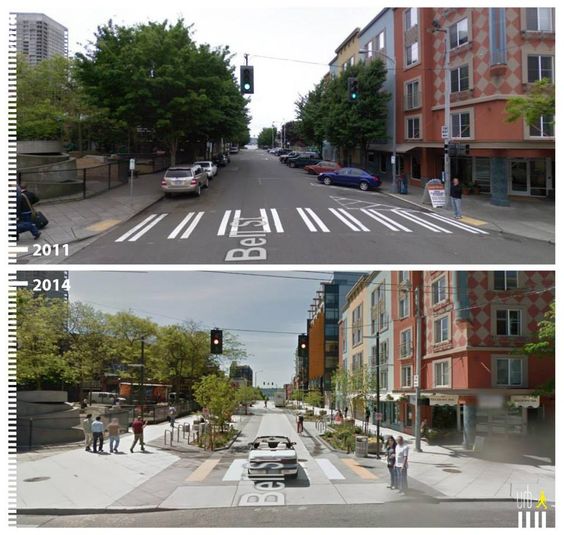
“Cleveland at Eye Level” is a reference to “The City at Eye Level”. While my parents and sister were nervous about me exploring Cleveland without knowing how safe the neighborhoods are, I feel accomplished in my goal of exploring tourist and non-tourist areas of Cleveland. The following quote from my dad reinforces this feeling.

You explored more of Cleveland in two days than I explored in twenty years. -Dad

My mom and dad met at Cleveland State University so they both know Cleveland. However, my dad informed me that he didn’t explore as many of Cleveland’s ethnically diverse neighborhoods as I did. Since I believe some White people aren’t even willing to step into non-White neighborhoods, I feel good hearing that my dad explored some of Cleveland’s racially and ethnically diverse neighborhoods.

Another of my goals was to explore diverse neighborhoods and not be limited to White neighborhoods. Due to this goal, I probably explored more of Cleveland than most locals and tourists will ever explore. In case you aren’t familiar with how racially segregated Cleveland is, see the below racial dot map. My uncle, who lives in Rocky River (suburb of Cleveland), told me he thinks Cleveland is more racially segregated than DC.

Since Cleveland is so racially segregated, I felt hopeful when I saw the below tile in Settlers’ Landing at the Unity Walk, which was constructed in 1996 for Cleveland’s Bicentennial Celebration. I saw Cleveland’s Unity Walk on New Year’s Eve, which was my last evening in Cleveland. I had already walked and ridden transit through diverse neighborhoods in the westside, downtown and eastside so seeing the Unity Walk felt like the perfect way for me to close out 2016. Seeing how diverse communities in Cleveland came together to build the Unity Walk was just what I needed after a tough 2016.

2016-12-31-16-08-52

Cleveland’s Unity Walk

I hope I have done a good job providing you with some background about Cleveland before showing you what I found in Cleveland’s diverse neighborhoods. I also want to share what I was thinking when taking the photos. While I want to improve my urban design and architecture skills, I find it challenging to understand whether the urban design and architecture of the buildings are good or bad so I didn’t focus much on building design. I actually almost failed an entry-level urban design course at UNC Charlotte because I don’t have an eye for building design. Devoting time and energy to pressuring the Student Government Association at UNC Charlotte to be more transparent didn’t help me improve my grade in the urban design course.

Instead of focusing on building design, I focused on wayfinding, artistic displays, sustainable infrastructure, public gathering places, and historic attractions. I’m hoping to use what I found for my advocacy and planning work. Without further delay, I chose to write about my journey through Cleveland by focusing on the westside then downtown then eastside. I took almost 200 photos. In order to keep this post short enough, I’m going to select my favorite photos.

Westside of Cleveland

Gordon Square Arts District

My Airbnb was in the Gordon Square Arts District so I started walking from my Airbnb. As you look at my photos, I want you to ask yourself “could I have seen that if I was driving?” The answer is likely no. This is why I enjoy walking instead of driving when I’m not in a rush. The below photo shows the first example of something I could only see by exploring Cleveland at eye level.

2016-12-30-14-57-37

EcoVillage

It’s amazing what I found when I looked down. The below photo shows neighborhood identity in the EcoVillage. I love seeing when neighborhoods try to be unique!

2017-01-01-12-43-18


Here is another example of neighborhood identity in the EcoVillage. When I see neighborhood signs like this, I appreciate that there is a strong community. On the other hand, I also ask myself how many motorists see the neighborhood sign or even know they are in a new neighborhood? I assume most motorists are too busy trying to go fast so they don’t take the time to enjoy the neighborhood they are traveling through. While I’m okay with interstate speeds being fast, I wish speed limits on all non-interstate roads were lowered so people could enjoy being in neighborhoods instead of trying to travel as quickly as possible through them.

2017-01-01-12-53-20


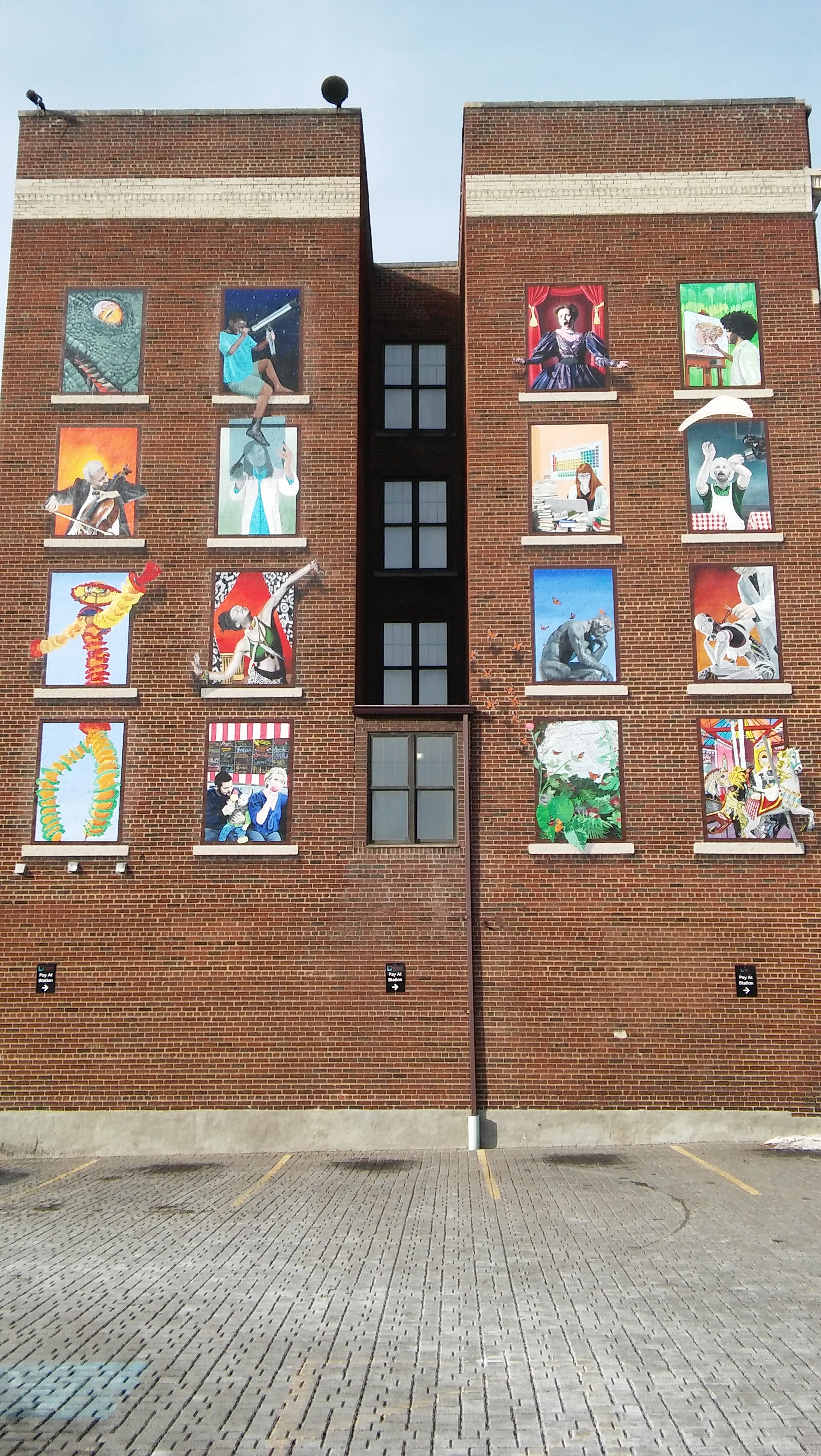
I guess if motorists can’t see the previous two neighborhood identity markers, maybe they can see the below mural.

2016-12-31-09-15-49

Ohio City

Ohio City has many artsy things to see. Correct me if I’m assuming too much. I assume motorists wouldn’t see many of the following things because they would be too busy focusing on the road and complaining about traffic congestion.

2016-12-30-16-54-40

2016-12-30-17-02-45

2016-12-30-17-05-16

2016-12-30-17-25-09

2016-12-30-17-26-54

2016-12-30-17-36-21


Downtown Cleveland

As I entered Downtown Cleveland, I felt jealous of how wide the multi-use path is on the Hope Memorial Bridge. I wish the multi-use path on Portland’s Hawthorne Bridge was this wide!

2016-12-30-18-06-29

As a geographer and planner, I love good wayfinding. After crossing Hope Memorial Bridge, I saw a sign for “Bike Rack” so followed it. I found more “Bike Rack” signs at every turn so I was able to follow the signs all the way to the Bike Rack, which is located at Quicken Loans Arena. You may be surprised by how many wayfinding signs don’t actually direct you all the way to where you are going. I was expecting to see just simple bike racks. Instead, I found the below secure bike room. Secure bike rooms are common in Portland, but this is Cleveland. Cleveland isn’t supposed to have a strong bike culture!

2016-12-30-19-12-41

The Bike Rack even has repair services!

2016-12-30-19-13-51

Even though my cousin, who grew up in Rocky River (suburb of Cleveland), told me about the pedestrian street on East 4th Street before I could be surprised by it, I was still excited to see it. While it’s very short compared to many pedestrian streets I explored in Europe, I was happy to see Cleveland trying to prioritize pedestrians.

2016-12-30-18-37-03

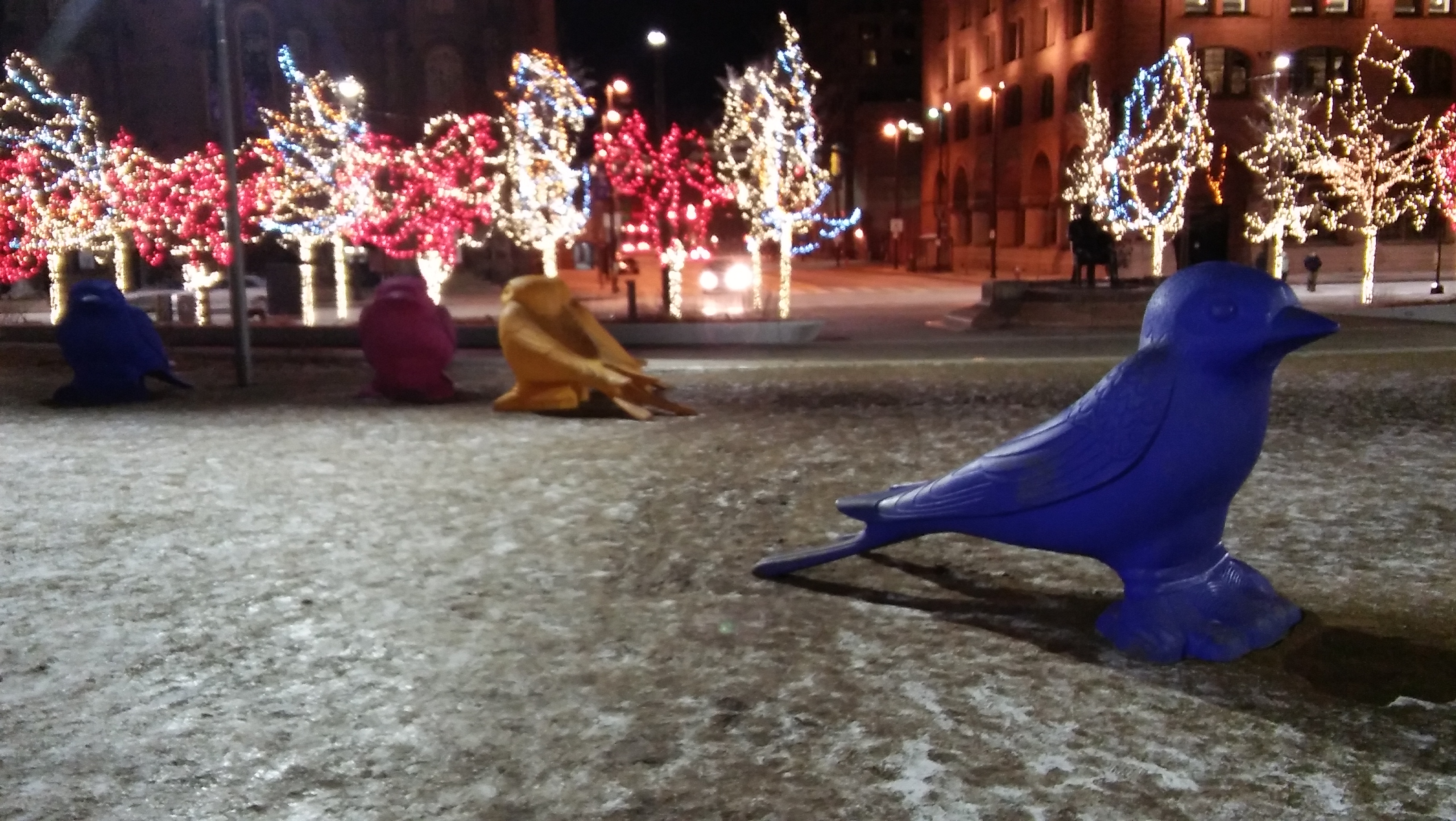
I also enjoyed seeing people interact at Public Square. The below ice skating rink is located in Public Square. Since many couples were holding hands, I missed holding hands with Catherine.

2016-12-30-18-43-50

I’m still trying to figure out why these birds are in Public Square. I saw people taking photos with the birds. However, when I asked them about the birds they didn’t know why the birds are in Public Square. Why take a photo with something you have no idea what the background story is?

2016-12-30-18-46-35

The below group of cyclists meeting in Public Square reminded me of the group rides I did in Portland. I saw about 100 cyclists take control of the right lane near Quicken Loans Arena about an hour later so the group likely expanded. Since I don’t think of Cleveland when I think of bike cities, I was impressed seeing this bike culture.

2016-12-30-18-49-22

Warehouse District

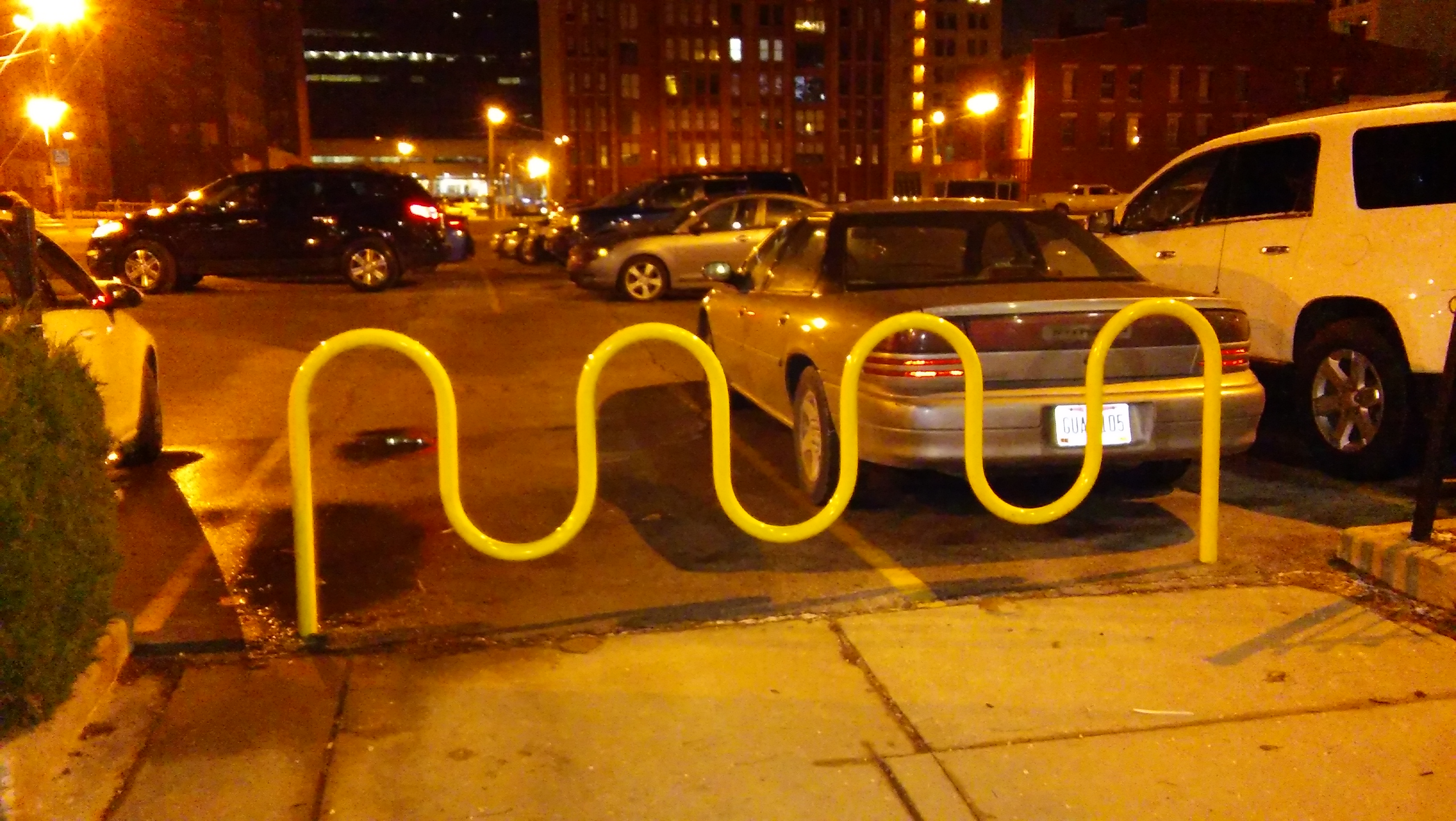
My excitement about Cleveland’s bike culture took an emotional hit when I saw this bike parking in the Warehouse District. I didn’t see any bikes parked here so is this supposed to be a bike rack or just a barrier to keep motorists from parking on the sidewalk?

2016-12-30-19-53-51

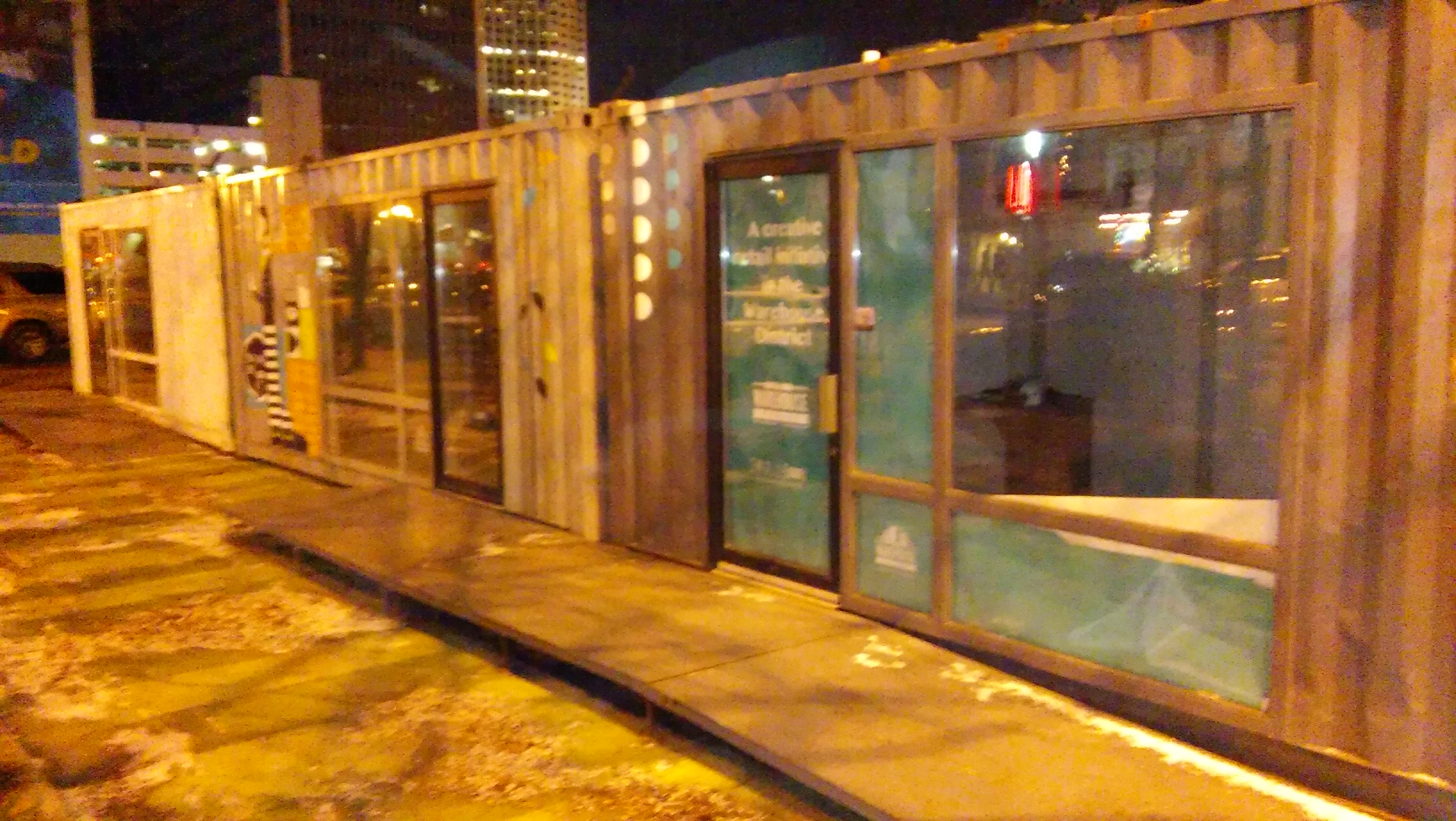
Downtown Cleveland was like an emotional roller coaster for me. After being depressed by the badly designed bike parking, I got excited by Small Box, which is located in the Warehouse District. Small Box has three retail stores created using upcycled shipping containers.

2016-12-30-20-04-22

As the below photo, which I took at Public Square, shows, Cleveland has the same problem as Portland with motorists using the “bus only” lane. The rumble strip doesn’t stop motorists from using the “bus only” lane.

2016-12-30-18-55-04

To my amazement, the “bus only” lane worked just a block east of Public Square. I still would have preferred seeing a more permanent barrier than just a rumble strip.

2016-12-30-19-01-26

Wow! I walked several miles through westside neighborhoods and downtown on Friday afternoon and evening. I haven’t started to share about what I saw walking through eastside neighborhoods on Saturday morning and afternoon. This post is getting long so I wrote a 3rd and final post about Cleveland’s eastside neighborhoods.

Future Trips

My quick Cleveland solo trip helped me better understand what I can feasibly do during my weekends off from work. During grad school, I had to do homework during the weekend so couldn’t take the whole weekend off. I now have the freedom to explore other cities like Baltimore, Philadelphia, New York City, Boston, Montreal, Quebec City, Toronto, Indianapolis, Chicago, New Orleans, Memphis, Minneapolis, and many other cities. Thankfully, I can reach most of these cities using Amtrak. If I have limited time, I can always fly. Since it’s winter, I’m currently focusing on warmer cities where I don’t have to worry about the bike lanes and trails not being plowed.


Walkable Retirement Complexes Surrounded By Automobile-Dependent Land Uses

I have been on countless family vacations but my family’s most recent vacation was very unique for one major reason: transportation. From Saturday, December 24 to Friday, December 30, I was a van passenger and stayed with my family in hotels that are located in automobile-dependent areas adjacent to I-495 in Alexandria, VA (suburb of DC), adjacent to I-90 in Erie, PA, and adjacent to I-480 in North Olmsted, OH (suburb of Cleveland). Since my dad values easy interstate access, we have stayed in automobile-dependent areas during most family vacations throughout my life.

As soon as I had the freedom to choose where I wanted to stay, I escaped the suburbs and stayed at an Airbnb in a more walkable and transit-accessible location in Cleveland’s Gordon Square Arts District. I walked and rode transit everywhere until flying back to DC on Sunday, January 1. The below tweet shows the reaction I received from locals after they asked me what I was doing in Cleveland. Since this blog post was getting long, I moved the “Cleveland at Eye Level” section to my next blog post.

Visiting Grandmothers

Since I’m aware that this blog post could be seen as me complaining about not having freedom to explore outside of my family’s van, I want to clarify that my dad mostly chose to stay in automobile-dependent areas because we were visiting my grandmothers in automobile-dependent areas of Erie, PA and Westlake, OH. The retirement complexes where my grandmothers live are walkable only within the confines of their retirement complexes. Both retirement complexes are surrounded by automobile-dependent land uses so my grandmothers can’t safely walk beyond their retirement complexes. As an active transportation planner, this was very depressing to see.

Thankfully, catching up with both of my grandmothers wasn’t depressing. I enjoyed seeing how networked my Erie grandmother is into her retirement community. After eleven years at her retirement community, she literally knows everyone by name and everyone stops to talk with her. I loved seeing and hearing this! I also enjoyed chair yoga with her and my twin sister.

Since my Ohio grandmother just moved into her retirement complex the day before we arrived, she isn’t networked into her retirement community yet. However, I enjoyed seeing and hearing her take the initiative to meet people in her retirement community. I also enjoyed playing Kings in the Corner with her and my family.

Part 2 of 3 about my family trip can be read in my next blog post.